Why Satellite Imaging and Spatial Data Ecosystems Are Critical for the Future of GIS
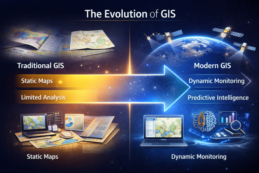
Geographic Information Systems (GIS) have evolved far beyond their origins as tools for static mapping and digital visualization. Today, GIS has become a dynamic spatial intelligence platform that supports real-time decision-making across governments, enterprises, and critical infrastructure sectors. At the core of this transformation lies the integration of satellite imagery, remote sensing, and modern spatial data ecosystems.
Early GIS workflows relied heavily on static datasets such as survey maps, manually digitized layers, and infrequent data updates. While useful for historical reference and long-term planning, these methods struggled to meet the growing demand for timely, scalable, and continuously updated geospatial intelligence. As urban areas expand, infrastructure networks grow, and environmental risks intensify, GIS needed to evolve—and satellite imaging enabled that shift.
Satellite Imagery: Powering Modern GIS
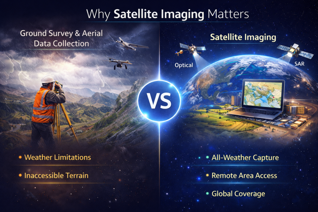
Satellite imagery has fundamentally changed how GIS systems operate. Unlike traditional surveys that are time-consuming and limited in coverage, satellites deliver consistent, repeatable, and large-area observations. With frequent revisit cycles, high-resolution satellite images allow GIS users to monitor urban growth, land-use change, deforestation, crop health, coastal dynamics, and infrastructure development over time.
Today, governments and enterprises increasingly rely on satellite imagery providers to support large-scale GIS applications. Optical, SAR, thermal, and hyperspectral datasets enable all-weather, day-night monitoring—making satellite data a reliable foundation for national and regional mapping programs, even in remote or inaccessible terrain.
The convergence of satellite imaging, cloud platforms, and AI-driven analytics is redefining the role of GIS. What was once a mapping tool is now becoming a decision engine—capable of supporting planetary-scale digital twins of cities, ecosystems, and infrastructure.
Satellite imagery is no longer just an input to GIS. It is the backbone that enables dynamic, predictive, and intelligence-driven spatial systems. As this evolution continues, GIS will remain central to how we plan, manage, and understand the world around us.
From Imagery to Spatial Data Ecosystems
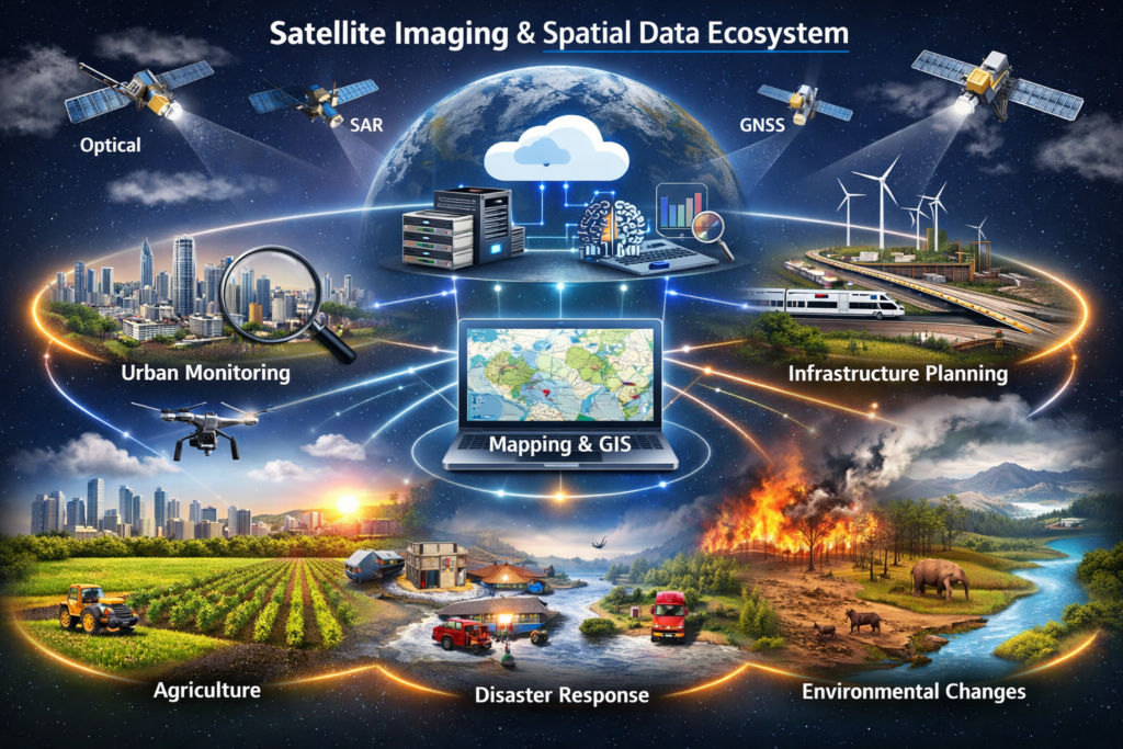
The real power of modern GIS lies not in imagery alone, but in integrated spatial data ecosystems. These ecosystems combine satellite imagery with advanced data processing workflows such as radiometric correction, orthorectification, digital elevation model (DEM) generation, and time-series analysis.
Cloud-based GIS platforms now allow users to seamlessly move from raw satellite data to actionable insights through web dashboards, APIs, and decision-support tools. This integration ensures that GIS is no longer static—it becomes a living system that continuously reflects real-world change.
AI and Cloud-Driven GIS Intelligence
As GIS increasingly adopts artificial intelligence and machine learning, the importance of consistent, high-quality satellite data continues to grow. AI-driven GIS systems rely on large volumes of spatial data to automate feature extraction, detect changes, predict trends, and support scenario modeling.
Cloud computing further enhances this capability by enabling scalable processing, near-real-time analytics, and collaborative access across organizations. Together, AI, cloud platforms, and satellite remote sensing are transforming GIS into a predictive and automated spatial intelligence engine.
Satpalda’s Role in the Evolving GIS Ecosystem
Organizations like Satpalda play a critical role in enabling this next phase of GIS evolution. With strong expertise in satellite imagery, remote sensing services, and geospatial analytics, Satpalda helps governments and enterprises access, process, and integrate high-resolution satellite data into modern GIS environments.
By supporting applications across urban planning, agriculture, infrastructure monitoring, disaster management, and environmental analysis, Satpalda bridges the gap between raw satellite data and real-world decision-making. This approach strengthens the geospatial value chain and accelerates the adoption of satellite-driven spatial data ecosystems.
Conclusion
The convergence of satellite imaging, cloud platforms, and AI-driven analytics is redefining the role of GIS. What was once a mapping tool is now becoming a decision engine—capable of supporting planetary-scale digital twins of cities, ecosystems, and infrastructure.
Satellite imagery is no longer just an input to GIS. It is the backbone that enables dynamic, predictive, and intelligence-driven spatial systems. As this evolution continues, GIS will remain central to how we plan, manage, and understand the world around us.
Sanchita Maitri
GIS Engineer


