
Synspective SAR Satellites for High-Frequency Earth Observation
Synspective’s StriX SAR satellite constellation delivers high-resolution X-band radar imagery for reliable Earth observation, day and night and in challenging weather conditions.

About Synspective SAR
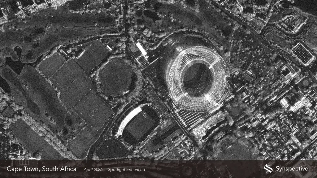
Advanced SAR Imaging for Persistent Earth Observation
Synspective operates a growing constellation of StriX SAR satellites designed to provide frequent observation of Earth’s surface. Using Synthetic Aperture Radar technology, the satellites can capture detailed imagery independently of daylight and through cloud cover.
The expanding constellation supports more frequent repeat observations, making SAR data valuable for monitoring changes across infrastructure, urban environments, natural terrain and other areas where timely and consistent Earth observation is important.
Key Capabilities of Synspective SAR Satellites
X-Band SAR
Radar imaging in the X-band enables detailed observation of Earth's surface and supports a wide range of monitoring applications.
Day & Night Imaging
SAR satellites can acquire imagery during both daytime and nighttime, providing greater flexibility for Earth observation.
All-Weather Observation
Radar imaging enables observation through cloud cover and conditions that can limit conventional optical satellite imagery.
Frequent Monitoring
The expanding satellite constellation enables more frequent opportunities for repeat observation and change monitoring.
An Expanding SAR Satellite Constellation
Synspective is progressively expanding its StriX SAR satellite constellation to increase observation opportunities and support higher-frequency monitoring of Earth’s surface.
The growing constellation strengthens the ability to collect repeat SAR observations over areas of interest, supporting applications that require timely and consistent information about surface changes.
With additional satellites joining the constellation, Synspective’s SAR data can support an increasingly broad range of Earth observation requirements, from infrastructure and urban monitoring to disaster response and environmental analysis.
Growing Constellation
Growing SAR Constellation
More Observation Opportunities
More Frequent Monitoring
Synspective Observation Mode
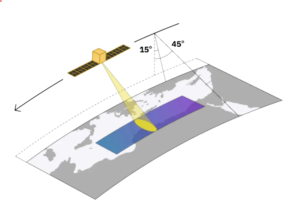
Stripmap
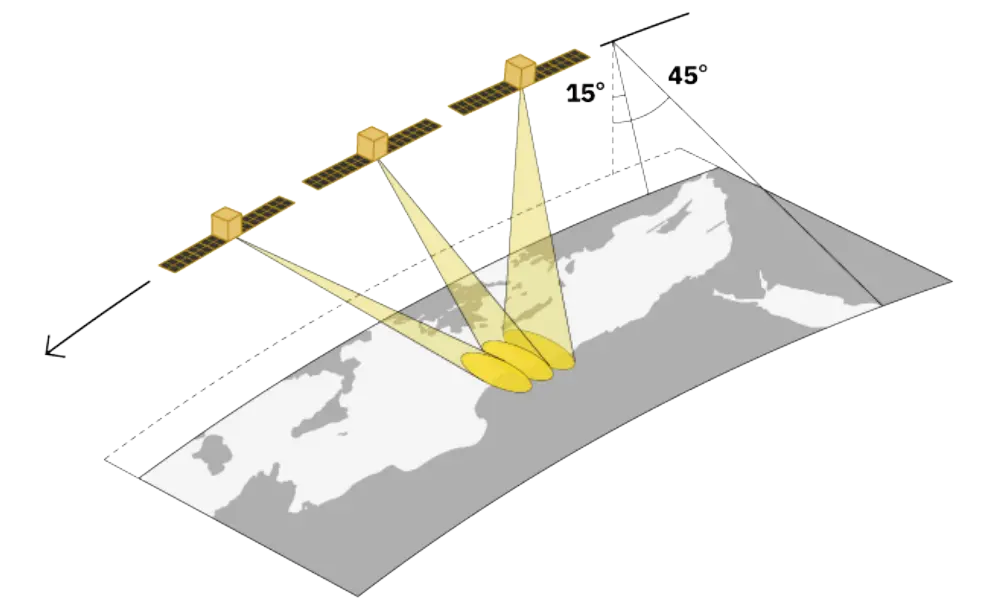
Sliding Spotlight
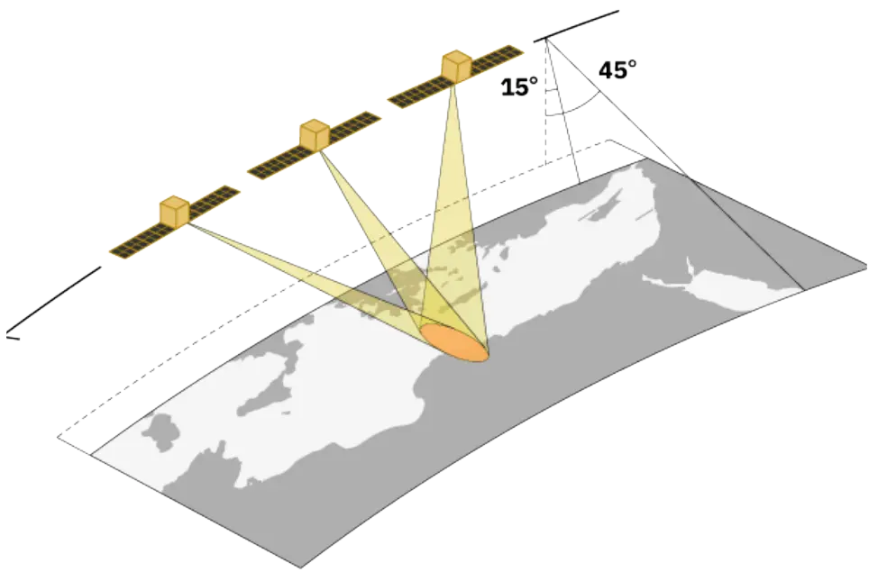
Staring Spotlight
SAR Data Products
Compensated Phase History Data
CPHD contains detailed radar phase and frequency information before it is converted into an image. In GEO applications, it enables custom SAR processing, advanced algorithm development, and precise analysis of surface movement, deformation, and infrastructure changes.
Single Look Complex
SLC preserves both radar amplitude and phase information. In GEO applications, it is mainly used for InSAR and advanced change detection, helping measure subtle ground deformation such as land subsidence, tectonic movement, volcanic activity, and infrastructure displacement.
Ground Range Detected
GRD is processed SAR imagery that represents radar backscatter in ground-range geometry without phase information. It is easy to interpret and widely used in GEO applications including flood mapping, deforestation monitoring, water-body detection, sea-ice observation, and land-cover analysis.
Super-Resolution GRD
SR-GRD is an enhanced GRD product processed to improve image detail and reduce unwanted radar effects. In GEO applications, it helps identify features such as roads, coastlines, rivers, buildings, and infrastructure more clearly for detailed mapping and geographic analysis.
Orthorectified Product
ORT is SAR imagery corrected for terrain-related distortions using a Digital Elevation Model (DEM). In GEO applications, it provides more accurate geographic positioning and is useful for GIS mapping, land-use planning, infrastructure assessment, environmental monitoring, and analysis in mountainous terrain.
Applications of Synspective SAR Data
Interferometry
Uses SAR phase information from SLC products to analyse subtle changes and deformation of the ground surface.
Coherent Change Detection (CCD)
Uses the coherence of repeat SAR observations to identify changes in ground-surface conditions.
Terrain-Corrected Analysis
ORT products correct terrain-related geometric distortions, improving geolocation accuracy in areas with significant topography.
Time-Series Monitoring
ORT products use consistent pixel positioning across repeat acquisitions, enabling direct comparison for time-series analysis.
Looking for Synspective SAR Data?
SATPALDA can assist you in sourcing Synspective SAR imagery for your Area Of Interest and Application.