The State of Earth Observation in 2026: Technologies, Trends, and Use Cases
Introduction: Earth Observation at a Defining Moment
By 2026, Earth Observation (EO) has evolved from a niche scientific discipline into a core pillar of global decision-making. Governments, enterprises, humanitarian organizations, and researchers now rely on satellite-derived intelligence to understand environmental change, manage resources, monitor infrastructure, and respond to crises in near real time.
Driven by rapid advancements in satellite technology, artificial intelligence, cloud computing, and open data ecosystems, the Earth Observation industry is entering a high-impact era. What was once limited by cost, revisit time, and data accessibility is now defined by scale, speed, and actionable insights.
This article explores the state of Earth Observation in 2026, highlighting the key technologies shaping the sector, major trends influencing adoption, and real-world use cases transforming industries worldwide.
The Evolution of Earth Observation Technologies
High-Resolution Optical Imagery as a Baseline
High-resolution optical satellite imagery has become the industry standard in 2026. Sub-meter and even 30-centimeter resolution imagery is now widely available for urban planning, defense, and commercial analytics. Improvements in onboard sensors, stabilization, and calibration allow sharper, more consistent imagery across multiple revisit cycles.
Commercial satellite operators such as Vantor Technologies continue to push spatial accuracy, while faster delivery pipelines enable same-day access for time-critical applications.
Synthetic Aperture Radar (SAR): All-Weather Intelligence
SAR technology has moved from specialized use to mainstream adoption. Its ability to penetrate clouds, smoke, and darkness makes it indispensable for disaster monitoring, maritime surveillance, and infrastructure deformation analysis.
In 2026, SAR data is increasingly combined with optical imagery, producing multi-sensor datasets that deliver deeper insights than either source alone. Persistent monitoring through frequent revisits allows analysts to detect subtle changes in terrain, subsidence, and asset movement with high confidence.
Commercial satellite operators such as Synspective continue to push spatial accuracy, while faster delivery pipelines enable same-day access for time-critical applications.
Hyperspectral and Thermal Imaging Gains Momentum
Hyperspectral Earth Observation has matured significantly, enabling identification of materials, vegetation health, water quality, and mineral composition at scale. These datasets are proving critical for agriculture, mining, and environmental monitoring.
Thermal infrared imagery is also seeing increased demand, particularly for urban heat mapping, wildfire detection, industrial monitoring, and energy efficiency analysis.
AI and Analytics: Turning Data into Decisions
Artificial Intelligence as the EO Engine
In 2026, AI is no longer an add-on—it is the backbone of Earth Observation analytics. Machine learning and deep learning models automate feature extraction, object detection, and change analysis across massive datasets.
AI-powered EO platforms can now:
- Detect illegal construction and land-use changes
- Identify crop stress before visible damage occurs
- Monitor infrastructure health at asset level
- Track vessels, vehicles, and urban growth patterns
Organizations like NASA and European Space Agency actively integrate AI into Earth science missions, accelerating research and operational applications.
Cloud-Native Geospatial Platforms
Cloud computing has eliminated traditional infrastructure bottlenecks. EO data in 2026 is processed, analyzed, and visualized directly in cloud-native environments, allowing teams to scale instantly and collaborate globally.
This shift supports:
- On-demand processing of petabyte-scale archives
- Real-time analytics and dashboards
- Seamless integration with GIS, BI, and enterprise systems
Key Trends Defining Earth Observation in 2026
Proliferation of Small Satellites and Constellations
Small satellite constellations are reshaping revisit frequency and coverage. Instead of waiting days or weeks for imagery, users now receive multiple observations per day for the same location.
Companies like SATPALDA exemplify this trend, enabling daily global monitoring that supports agriculture, climate tracking, and security applications.
Open Data and Democratization of EO
Open data initiatives continue to expand access to satellite imagery and geospatial datasets. Governments and international agencies increasingly release free EO data, empowering startups, researchers, and developing nations.
This democratization fosters innovation, lowers entry barriers, and drives new EO-based services across sectors.
Companies like Planet Labs exemplify this trend, enabling daily global monitoring that supports agriculture, climate tracking, and security applications.
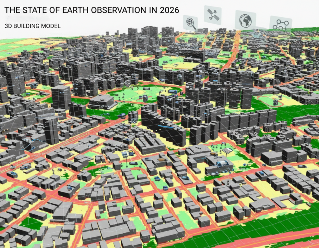
Integration with Digital Twins and IoT
Earth Observation is increasingly integrated with digital twins, IoT sensors, and ground data. This convergence allows real-time synchronization between physical assets and their virtual representations.
Cities, utilities, and infrastructure operators use EO-enabled digital twins to simulate scenarios, predict risks, and optimize operations with unprecedented accuracy.
Industry-Specific Use Cases in 2026
Agriculture and Food Security
Precision agriculture is one of the most mature EO applications. Satellite imagery combined with AI analytics helps farmers monitor crop health, soil moisture, pest outbreaks, and yield forecasts.
Governments use EO to assess food security, drought impacts, and supply chain resilience, enabling proactive interventions rather than reactive responses.
Cities, utilities, and infrastructure operators use EO-enabled digital twins to simulate scenarios, predict risks, and optimize operations with unprecedented accuracy.
Urban Planning and Smart Cities
Urban expansion, informal settlements, and infrastructure stress are monitored continuously using EO data. City planners rely on satellite analytics to manage transportation networks, zoning compliance, and environmental impact.
Thermal imagery also supports heat-island mitigation strategies and climate-resilient urban design.
Climate Change and Environmental Monitoring
Earth Observation remains central to climate intelligence. In 2026, EO supports:
- Deforestation and biodiversity monitoring
- Glacier retreat and sea-level rise assessment
- Carbon stock estimation and ESG reporting
- Air and water quality analysis
These insights guide policy decisions, sustainability reporting, and international climate commitments
Thermal imagery also supports heat-island mitigation strategies and climate-resilient urban design.
Disaster Management and Emergency Response
EO plays a critical role before, during, and after disasters. Near-real-time imagery enables rapid damage assessment for floods, earthquakes, wildfires, and cyclones.
AI-driven change detection accelerates insurance claims, humanitarian aid distribution, and infrastructure recovery planning.
Defense, Security, and Maritime Surveillance
Governments increasingly depend on EO for border monitoring, maritime domain awareness, and strategic intelligence. SAR and optical imagery combined with AI tracking algorithms provide continuous situational awareness across land and sea.
AI-driven change detection accelerates insurance claims, humanitarian aid distribution, and infrastructure recovery planning.
Commercialization and the Business of EO
Earth Observation in 2026 is no longer just about data—it’s about solutions. End users demand actionable intelligence, not raw imagery. As a result, EO companies focus on vertical-specific analytics, APIs, and decision-ready products.
Private investment, public-private partnerships, and downstream service innovation continue to fuel market growth, positioning EO as a core component of the global digital economy.
AI-driven change detection accelerates insurance claims, humanitarian aid distribution, and infrastructure recovery planning.
The Road Ahead
As we move beyond 2026, Earth Observation will become even more autonomous, intelligent, and integrated into everyday decision-making. Advances in onboard AI, real-time tasking, and cross-sensor fusion will further reduce latency between observation and action.
The future of Earth Observation is not just about seeing the planet—it’s about understanding it, protecting it, and managing it responsibly.
Private investment, public-private partnerships, and downstream service innovation continue to fuel market growth, positioning EO as a core component of the global digital economy.
AI-driven change detection accelerates insurance claims, humanitarian aid distribution, and infrastructure recovery planning.


