Advancing GLOF Monitoring with Remote Sensing and GIS: A Multi-Sensor Approach for High-Mountain Hazards
Understanding Glacial Lake Outburst Floods (GLOFs)
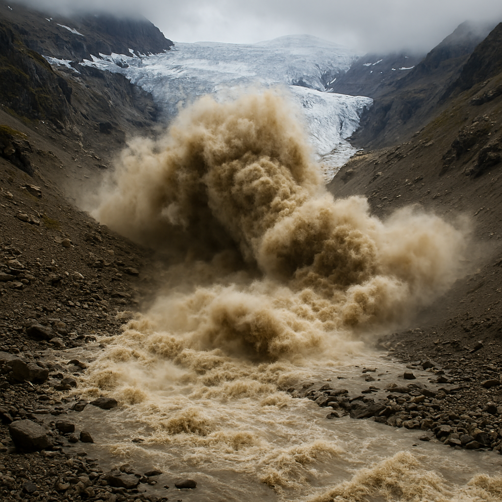
Glacial Lake Outburst Floods (GLOFs) are sudden, high-magnitude flood events that occur when a glacial lake breaches its natural dam, typically formed by ice or loose moraine material. These extreme events can release millions of cubic meters of water within minutes, causing destructive downstream impacts including infrastructure damage, river channel alteration, and serious threats to nearby communities.
With accelerating glacier retreat due to climate change, GLOF events are becoming increasingly frequent and unpredictable across high-mountain regions such as the Himalayas, Andes, and the Alps. Monitoring these glacial lakes has therefore become a critical component of disaster risk reduction and environmental management.
Modern remote sensing and GIS technologies now play a central role in GLOF hazard monitoring and glacial lake assessment. Using high-resolution satellite imagery, earth observation data, and geospatial analytics, researchers can detect glacial lake expansion, monitor glacier dynamics, and model flood risks over large and remote mountain regions. These technologies provide reliable, continuous, and scalable tools for glacial lake mapping, hazard analysis, and early warning systems.
Importance of Very High Resolution (VHR) Satellite Imagery in GLOF Assessment
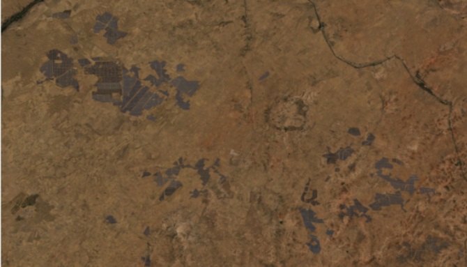
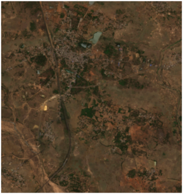
Very High Resolution (VHR) satellite imagery is essential for detailed glacial lake monitoring and terrain analysis. High-resolution optical satellite data enables precise mapping of lake boundaries, ice cover conditions, and seasonal changes in lake size.
VHR imagery helps scientists identify critical geomorphological features such as moraine dams, outflow channels, breach points, and newly formed glacial lakes that may not be visible in medium-resolution imagery.
Stereo and tri-stereo satellite imagery can also be used to generate accurate Digital Elevation Models (DEM). These elevation datasets support advanced terrain modeling and improve the accuracy of hydrodynamic flood simulations used in GLOF risk assessment.
Such high-detail datasets are particularly useful for identifying micro-channels, narrow valleys, and potential dam-failure pathways. Access to recent satellite imagery is also crucial for detecting near-real-time environmental changes such as new cracks in moraine dams, sudden lake expansion, glacier retreat, or debris movement.
At the same time, archived satellite imagery plays a valuable role in reconstructing historical glacial lake evolution, identifying long-term glacier retreat trends, and analyzing previous GLOF events. This time-series analysis provides important insights into hazard development and climate-driven landscape changes.
Contribution of SAR Data: X-Band and L-Band Capabilities
Synthetic Aperture Radar (SAR) satellite imagery provides an additional layer of monitoring capability for glacial environments. Unlike optical satellite imagery, SAR sensors can capture data day or night and through cloud cover, making them particularly useful in high-mountain regions where weather conditions often limit visibility.
X-band SAR offers high spatial resolution and is effective for detecting fine-scale surface changes such as glacier surface cracks, debris flows, and morphological variations.
L-band SAR, on the other hand, penetrates deeper into vegetation and snow layers, enabling researchers to detect subsurface deformation and structural instability within moraine dams.
Advanced techniques such as InSAR (Interferometric Synthetic Aperture Radar) allow scientists to measure subtle ground deformation and glacier movement over time. Detecting these small shifts can reveal pre-failure signals, helping researchers identify unstable glacial lakes before a catastrophic breach occurs. This makes SAR satellite data a critical component of GLOF early warning systems and glacier hazard monitoring.
Role of Hyperspectral Satellite Data in Moraine and Melt Analysis
Hyperspectral remote sensing imagery adds another powerful analytical layer to glacial hazard studies. Unlike traditional multispectral imagery, hyperspectral sensors capture hundreds of narrow spectral bands, allowing for detailed material identification and environmental analysis.
Hyperspectral satellite data can be used to detect mineral composition in moraine dams, map water quality variations, and differentiate between supraglacial melt ponds and debris-covered ice.
These spectral signatures also help identify saturated zones and weakened areas within moraine structures, which can act as early indicators of potential dam failure. Understanding the physical and mineral composition of moraine dams significantly improves GLOF risk assessment and stability analysis.
How Satpalda Supports GLOF Monitoring and Risk Assessment
As a leading provider of satellite imagery and geospatial solutions, Satpalda plays an important role in supporting glacial hazard monitoring and disaster risk management.
Satpalda provides access to very high-resolution satellite imagery, SAR datasets, and hyperspectral satellite data specifically suited for high-mountain environments. These datasets enable accurate mapping of glacial lakes, moraine dam structures, outflow channels, and terrain features that are essential for early hazard detection.
Through X-band and L-band SAR satellite data, Satpalda enables all-weather, day-night monitoring of glacier surfaces and moraine stability. Using InSAR deformation analysis, researchers can identify early warning signals of structural instability in glacial lakes, which is particularly valuable in cloud-prone Himalayan regions.
Additionally, hyperspectral imagery helps perform mineralogical analysis of moraine materials, detect water saturation zones, and identify debris-covered glaciers—insights that conventional satellite imagery cannot easily provide.
By integrating these multi-sensor satellite datasets with GIS analytics and terrain modeling, Satpalda supports advanced workflows such as:
Glacial lake mapping
Hazard and vulnerability assessment
Lake volume estimation
Terrain and elevation modeling
GLOF flood simulation and inundation mapping
These capabilities help government agencies, research institutions, and disaster management authorities make data-driven decisions for high-mountain risk mitigation and climate resilience.
Conclusion
Geographic Information Systems (GIS) play a crucial role in integrating diverse geospatial datasets such as multispectral satellite imagery, SAR data, hyperspectral imagery, and digital elevation models.
GIS platforms enable researchers to perform advanced spatial analysis including glacial lake volume estimation, hazard classification, flood routing simulations, and inundation mapping.
When combined with hydrological and terrain models, GIS tools allow scientists to simulate flood wave velocity, water depth, and downstream impact zones. These insights are critical for GLOF disaster preparedness, infrastructure planning, and climate risk management in mountainous regions.
By leveraging satellite imagery, remote sensing, and geospatial intelligence, researchers and decision-makers can significantly improve the monitoring and mitigation of glacial hazards in vulnerable mountain ecosystems.
Sanchita Maitri
GIS Engineer