Geospatial Analysis Services for Spatial Intelligence
Geospatial Analysis for Actionable Spatial Intelligence
Satpalda delivers advanced geospatial analysis and GIS analytics to transform raw spatial data into actionable insights. By integrating satellite imagery, remote sensing data, and Geographic Information Systems (GIS), our geospatial experts perform detailed spatial analysis for infrastructure monitoring, environmental assessment, agriculture intelligence, and urban planning. Our geospatial data analysis services enable organizations to detect patterns, monitor land changes, and evaluate risks across large geographic areas. From satellite-based analytics to GIS modeling and predictive spatial intelligence, Satpalda helps governments, enterprises, and researchers make faster and more informed decisions.
Industry Applications of Geospatial Analysis
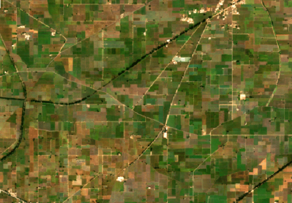
Geospatial analysis enables detailed monitoring of crop health, soil conditions, irrigation patterns, and agricultural productivity. By combining satellite imagery with GIS analytics, farmers and agribusinesses can optimize planting strategies, detect crop stress, and improve resource management. Spatial analysis helps identify field variability, enabling precision agriculture practices that increase yield while reducing water, fertilizer, and pesticide usage.
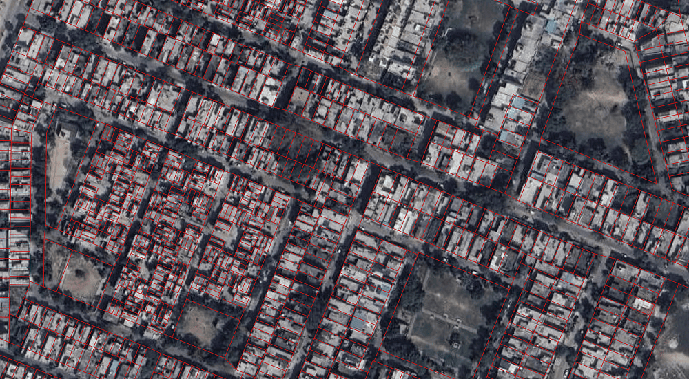
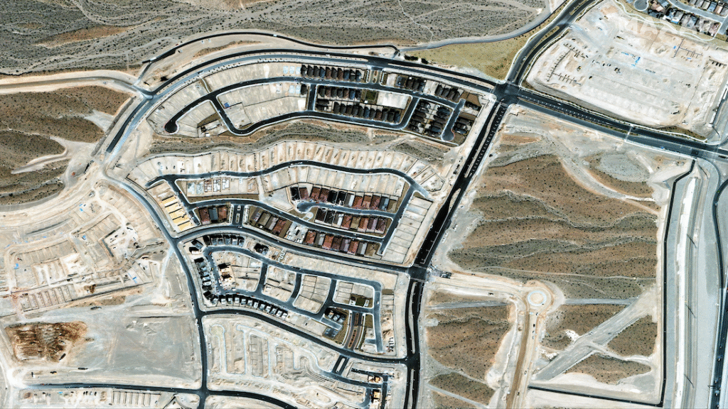
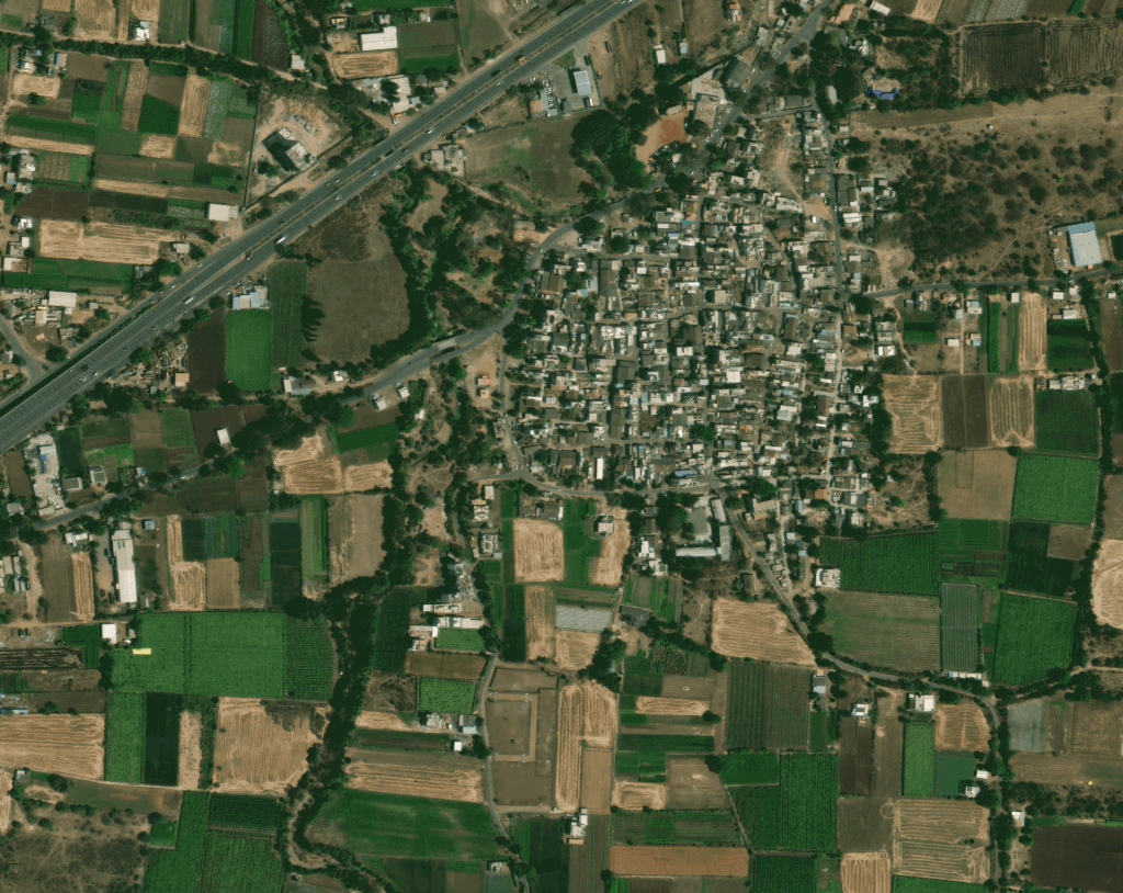
Urban planners use geospatial analysis to study urban growth patterns, transportation networks, land use changes, and infrastructure distribution. GIS-based spatial analysis helps governments understand population density, plan utilities, and evaluate development impacts. By analyzing satellite imagery and spatial datasets, city planners can make informed decisions for smart city development, zoning regulations, and sustainable urban expansion.
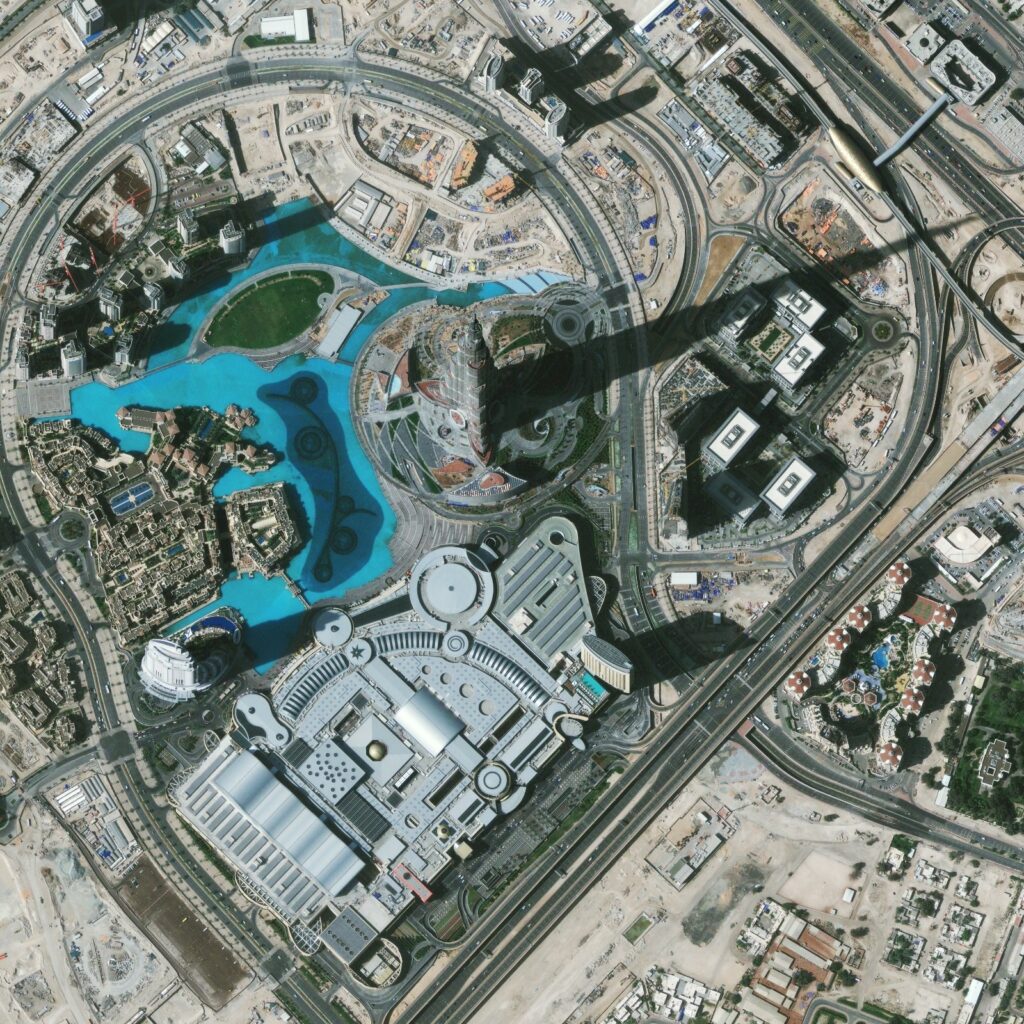
Geospatial analysis supports monitoring and planning of transportation networks, utilities, pipelines, power grids, and construction projects. Spatial data analysis allows organizations to identify infrastructure vulnerabilities, monitor asset conditions, and optimize maintenance planning. By integrating satellite imagery with GIS models, companies can improve infrastructure planning, project monitoring, and long-term asset management.
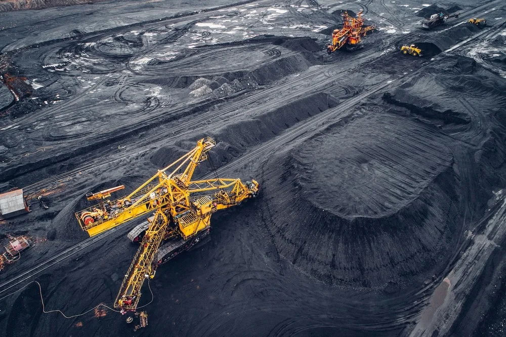
Mining companies use geospatial analysis to monitor land disturbances, mineral exploration zones, and environmental compliance. GIS-based spatial analysis helps evaluate terrain conditions, track mining expansion, and analyze geological patterns. Satellite imagery combined with geospatial analytics provides valuable insights for resource management and sustainable mining operations.
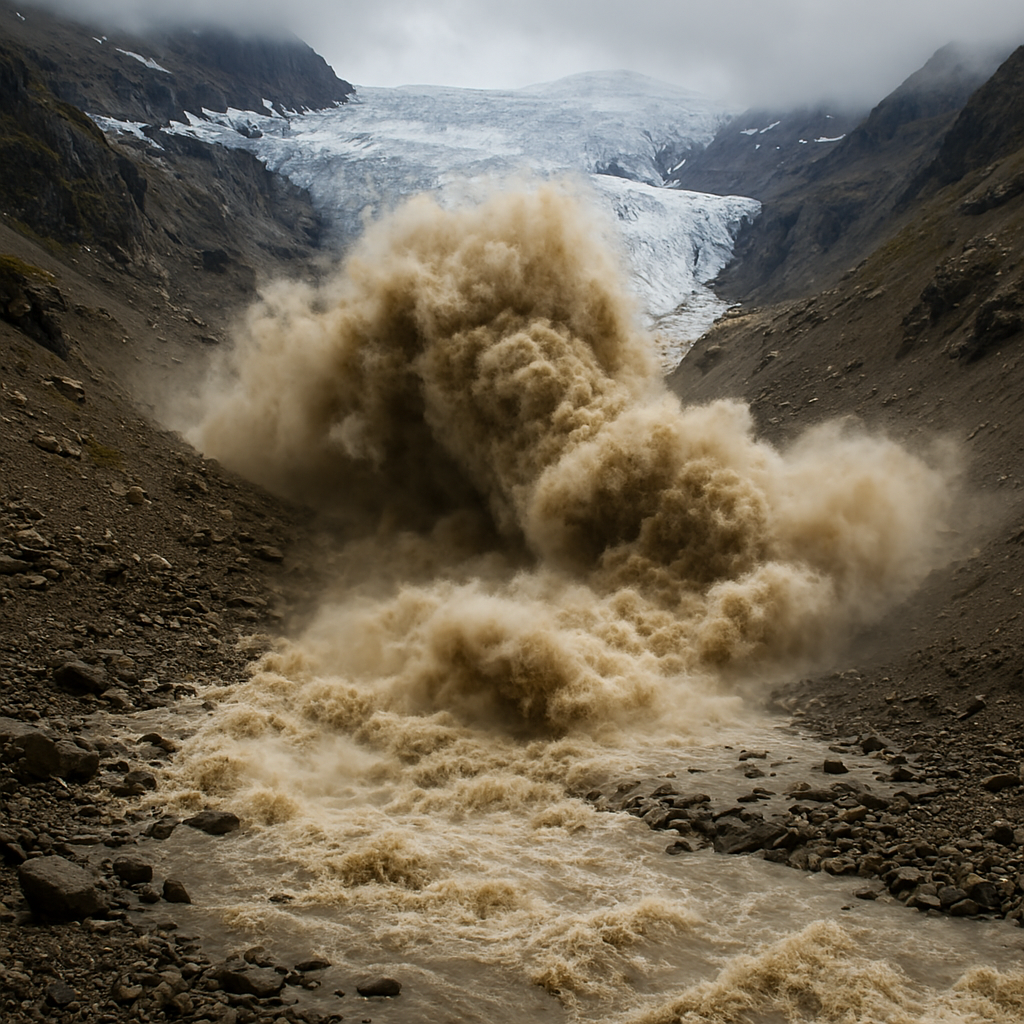
Geospatial analysis is critical for hazard mapping, disaster risk assessment, and emergency response planning. Spatial models help identify flood-prone areas, landslide zones, and earthquake risk regions. By analyzing satellite data and terrain models, authorities can predict disaster impacts and develop effective risk mitigation and response strategies.
Environmental scientists rely on geospatial analysis to monitor deforestation, climate change impacts, water resources, and ecosystem health. Spatial analytics helps detect environmental changes over time and evaluate ecological risks. Geospatial datasets combined with remote sensing technologies support forest monitoring, biodiversity conservation, and environmental impact assessments across large geographic regions.
Types of Satellite Imagery
Spatial Pattern Analysis
Spatial pattern analysis identifies relationships and patterns within geographic data. It helps detect clusters, trends, and anomalies in spatial datasets, supporting applications such as urban growth analysis, environmental monitoring, and infrastructure planning.
Change Detection Analysis
Change detection analysis compares satellite imagery and spatial datasets across different time periods to identify landscape changes. It is widely used for land use change monitoring, deforestation analysis, infrastructure development tracking, and environmental monitoring.
Terrain and Elevation Analysis
Terrain analysis uses digital elevation models (DEM) and digital terrain models (DTM) to evaluate landscape characteristics such as slope, elevation, and drainage patterns. This analysis supports infrastructure planning, watershed management, and disaster risk assessment.
Network Analysis
Network analysis examines connectivity within transportation and utility networks. GIS-based network analysis helps optimize road networks, logistics routes, public transport systems, and utility infrastructure planning.
Suitability Analysis
Suitability analysis identifies the most appropriate locations for projects by evaluating multiple spatial criteria. It is commonly used for urban planning, renewable energy site selection, infrastructure development, and agricultural planning.
Predictive Spatial Modeling
Predictive spatial modeling combines geospatial datasets with statistical and machine learning techniques to forecast future trends. It helps predict urban expansion, environmental risks, crop yields, and disaster impacts, supporting data-driven decision-making.