GIS Mapping Solutions for Smarter Spatial Decision-Making
Advanced GIS Mapping Solutions for Spatial Intelligence
Satpalda delivers advanced GIS mapping solutions that transform raw spatial data into clear, actionable intelligence. By integrating satellite imagery, geospatial datasets, and spatial analytics, our GIS mapping services help organizations visualize patterns, monitor changes, and support better decision-making. From infrastructure planning and environmental monitoring to land use mapping and disaster management, our GIS platforms provide powerful tools for analyzing complex geographic information. Using modern geographic information systems, web GIS platforms, and high-resolution earth observation data, Satpalda enables governments, planners, and enterprises to make data-driven decisions with confidence.
Industry Applications of Geospatial Analysis
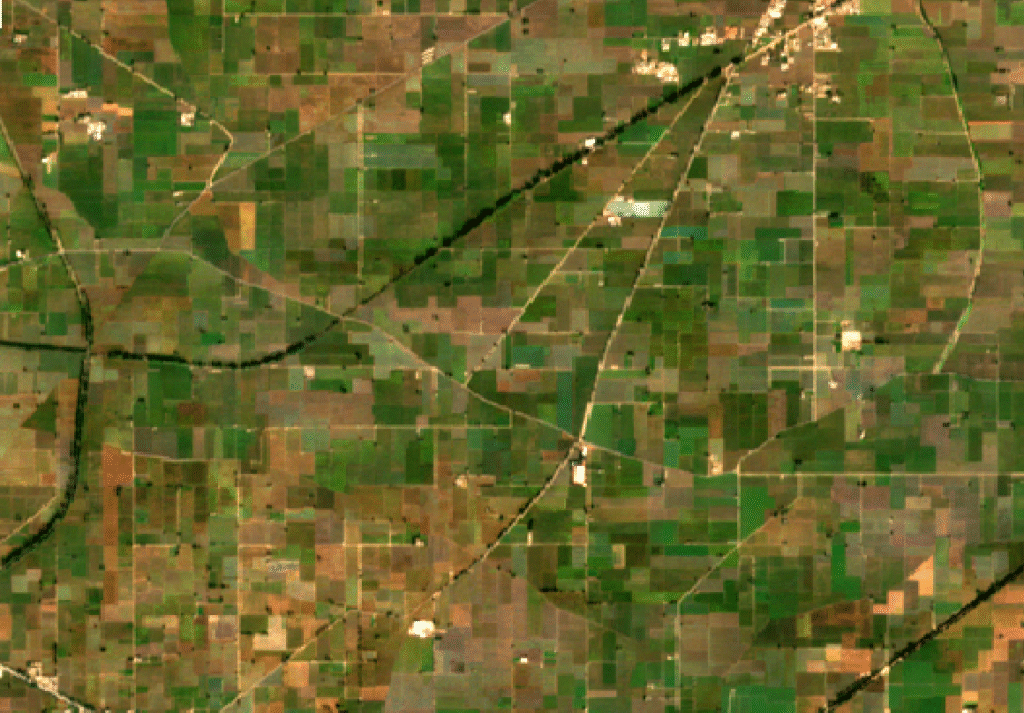
GIS mapping supports precision agriculture and crop monitoring by combining satellite imagery, soil data, and spatial analytics. Farmers and agricultural planners use GIS to analyze crop health, irrigation patterns, land suitability, and yield prediction. These geospatial insights enable optimized resource management, improved farm productivity, and sustainable agricultural practices through data-driven farming decisions and geospatial technology.
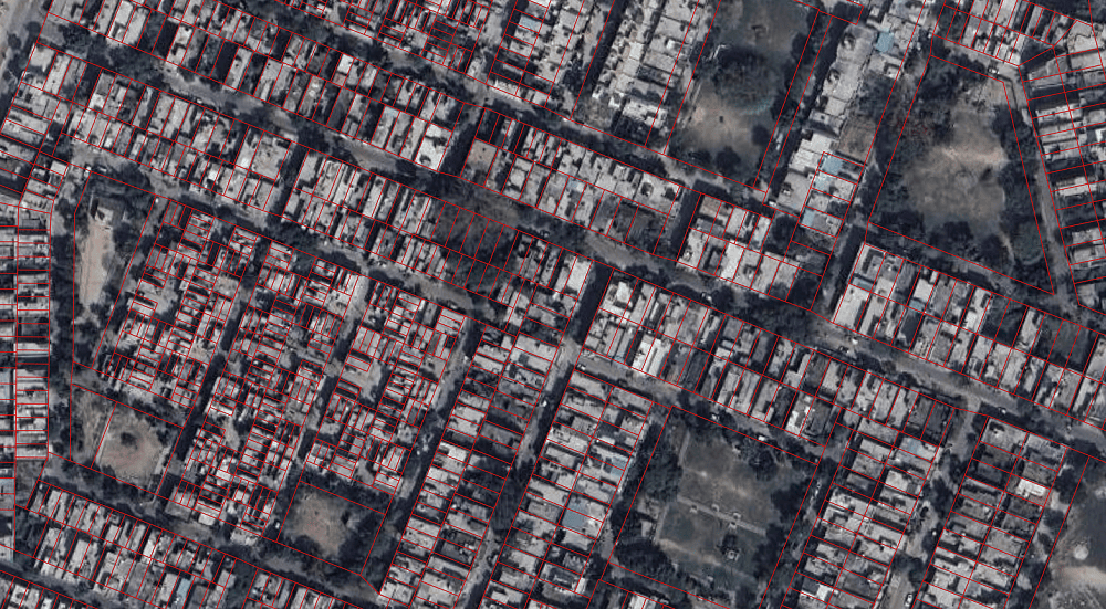
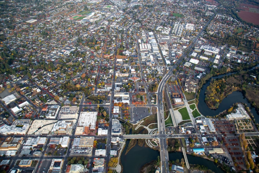
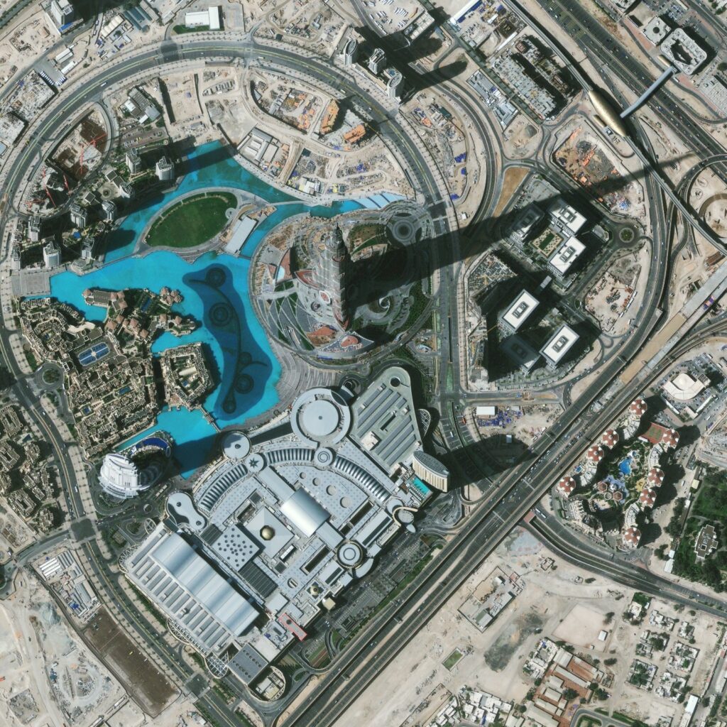
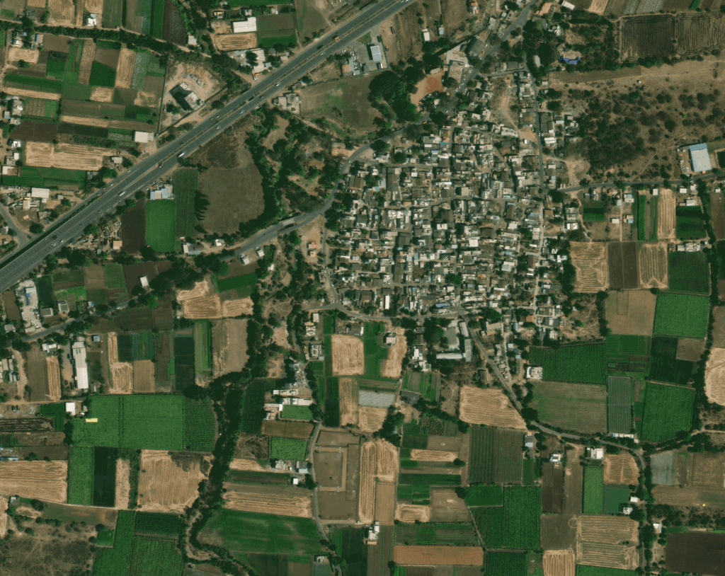
GIS mapping solutions play a crucial role in urban planning, smart city development, and infrastructure management. By integrating satellite imagery and spatial data, GIS enables planners to analyze land use patterns, transportation networks, utilities, and urban growth trends. These insights support efficient zoning, sustainable city planning, and improved public service delivery through data-driven geographic information systems and spatial analysis tools.
GIS mapping enables efficient infrastructure planning and asset management by visualizing spatial data related to roads, pipelines, utilities, telecom networks, and construction projects. Organizations use GIS to monitor infrastructure conditions, plan new developments, and manage assets across large geographic areas. These geospatial insights help improve maintenance planning, operational efficiency, and long-term infrastructure development strategies.
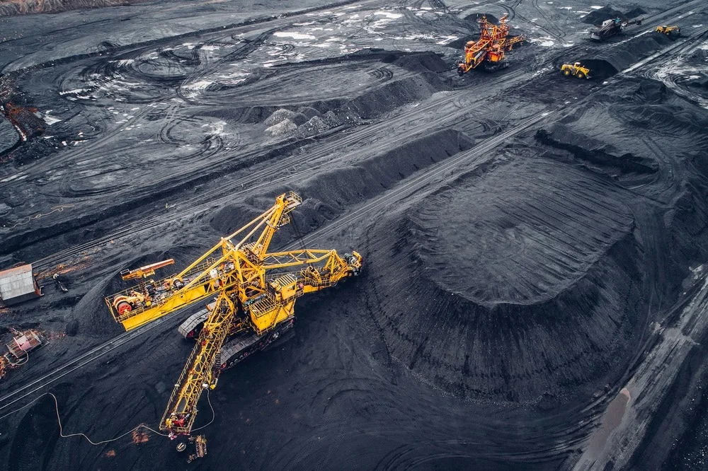
GIS mapping solutions are widely used in mining operations, resource exploration, and environmental monitoring. By integrating satellite imagery, terrain models, and spatial analytics, GIS helps identify mineral zones, monitor land deformation, track mining expansion, and assess environmental impact. These geospatial insights enable mining companies to improve site planning, resource management, regulatory compliance, and operational safety while supporting sustainable extraction practices.
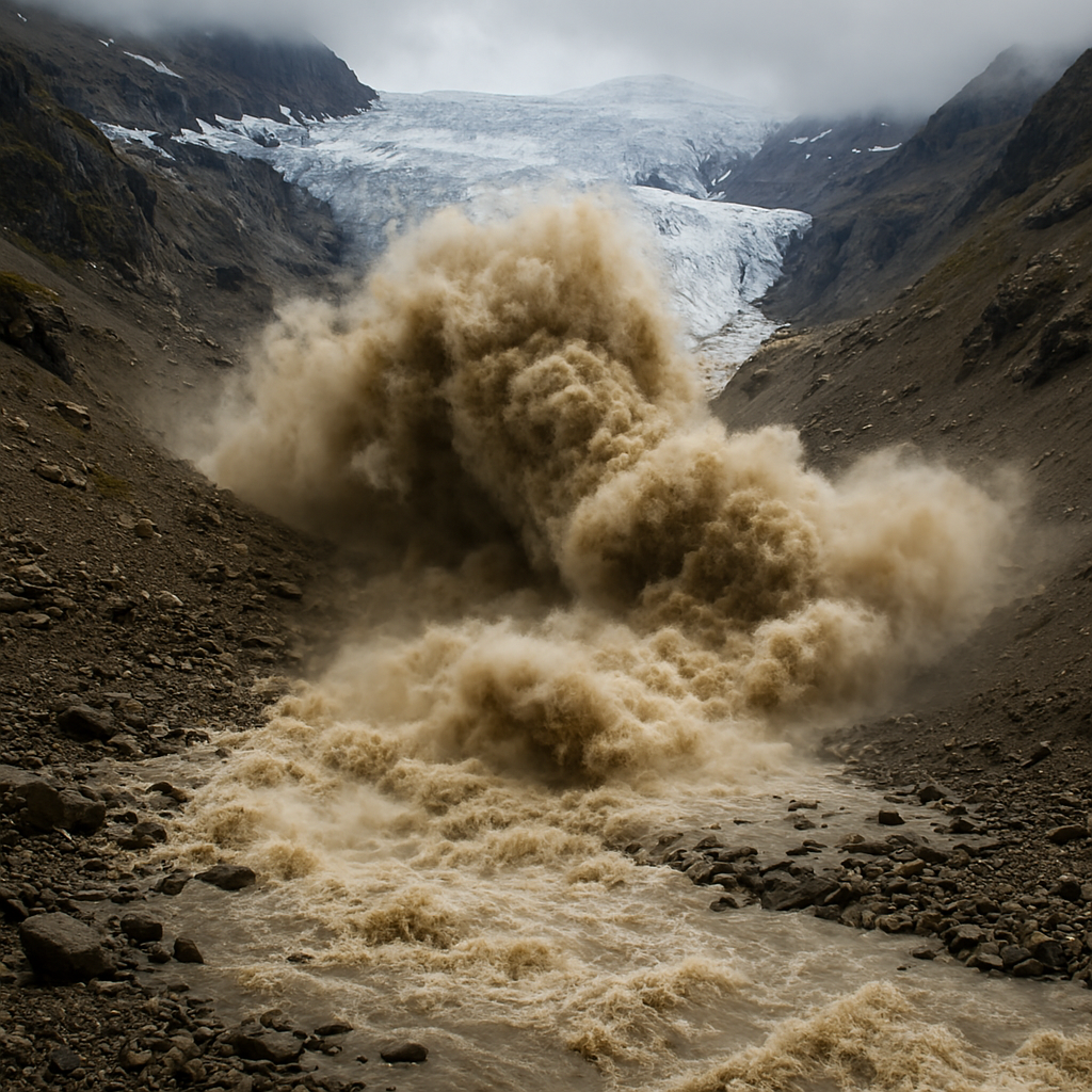
GIS mapping is widely used in disaster management, hazard mapping, and risk assessment. By analyzing satellite data, terrain models, and environmental datasets, GIS platforms help identify flood-prone zones, landslide risk areas, and earthquake vulnerability regions. These insights support early warning systems, emergency planning, and disaster response strategies, improving preparedness and resilience for communities and government agencies.
GIS mapping solutions help organizations monitor environmental changes, deforestation, water resources, and climate impacts. By combining satellite imagery and spatial analysis, GIS enables detailed mapping of ecosystems, biodiversity zones, and land degradation patterns. Governments and environmental agencies use these insights to support sustainable resource management, conservation planning, and climate change monitoring initiatives.
Types of GIS Mapping Solutions
Land Use and Land Cover Mapping
GIS-based LULC mapping helps analyze land utilization patterns, urban expansion, deforestation, and environmental change. These insights support sustainable planning and land management strategies.
Infrastructure and Urban Planning Mapping
GIS mapping supports road networks, utilities, transportation systems, and smart city infrastructure planning, enabling efficient development and spatial decision-making.
Environmental and Resource Mapping
Geospatial mapping helps monitor forests, water resources, ecosystems, and environmental changes, supporting conservation programs and climate resilience planning.
Disaster Risk and Hazard Mapping
GIS is widely used for hazard mapping, flood risk analysis, landslide monitoring, and disaster preparedness, helping authorities respond effectively to natural disasters.
Agricultural and Precision Farming Mapping
GIS mapping enables crop monitoring, soil analysis, irrigation planning, and yield prediction, helping farmers implement precision agriculture practices.
Asset and Utility Mapping
GIS mapping solutions help organizations manage pipelines, telecom networks, power grids, and urban utilities, enabling efficient asset management and maintenance.