Sample Satellite Imagery
SATPALDA is a leading provider of satellite imagery and Geospatial intelligence. We as satellite imagery company have pledged to provide impactful solution across the industries as our motto says, Global intelligence, local solutions!
Browse our sample image gallery and get what suits your requirements the best…
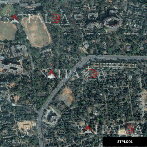
STPL001
Dhanbad 30cm Legion
- Image projection: EPSG:4326 – WGS 84
- Cloud cover: 0%
- Off nadir angle: 19 degree
- Radiometric resolution: Eight bit unsigned integer
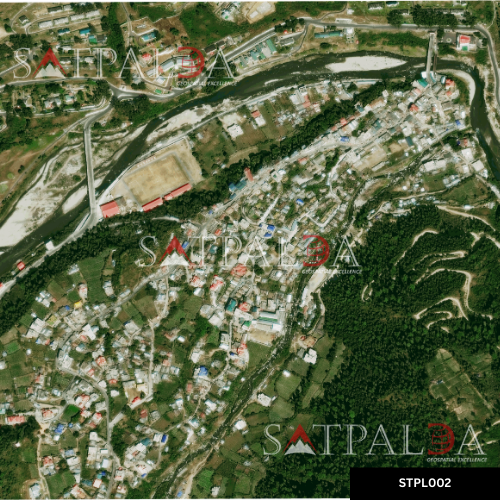
STPL002
30cm | Arunachal Pradesh
- Image projection: EPSG:4326 – WGS 84
- Cloud cover: 0%
- License: Vantor
- Radiometric resolution: Eight bit unsigned integer
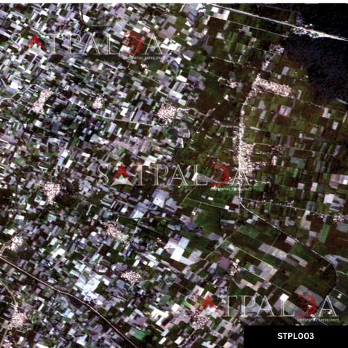
STPL003
Grus 2.5m, Pilibhit, UP
- Image projection: EPSG:32644 – WGS 84 / UTM zone 44N
- Cloud cover: 0%
- License: Axelspace
- Radiometric resolution: Eight bit unsigned integer
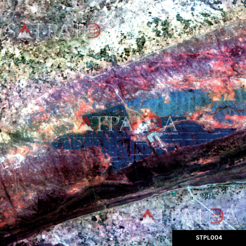
STPL004
5.2m | India Hyperspectral
- Location: Solar power plant, Rewa, Madhya Pradesh
- Cloud cover: 0%
- License: Wyvern
- Image projection: GCS WGS 1984
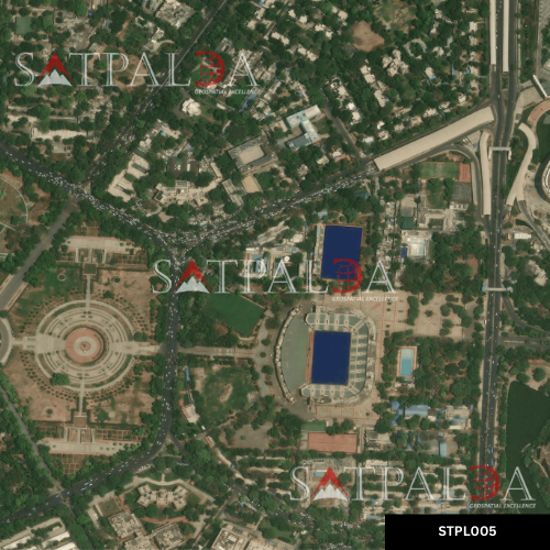
STPL005
15 cm | Delhi
- Image projection: EPSG:4326 – WGS 84
- Cloud cover: 0%
- License: Vantor
- Radiometric resolution: Eight bit unsigned integer
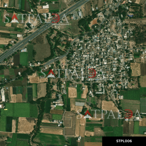
STPL006
30cm | Nashik | Agriculture
- Image projection: EPSG:4326 – WGS 84
- Cloud cover: 0%
- License: Vantor
- Radiometric resolution: Eight bit unsigned integer
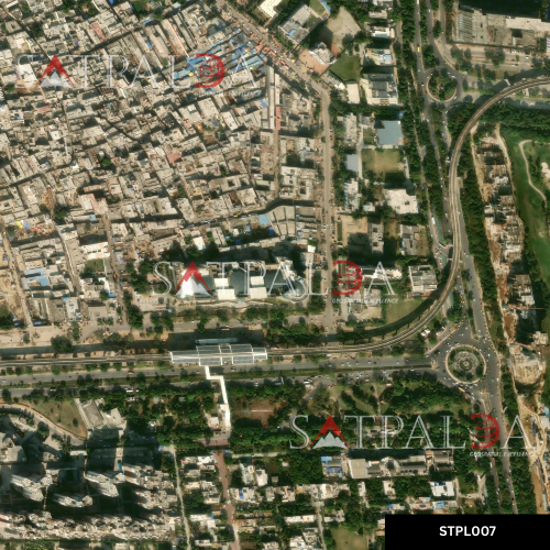
STPL007
30cm | Noida
- Image projection: EPSG:4326 – WGS 84
- Cloud cover: 0%
- License: Vantor
- Radiometric resolution: Eight bit unsigned integer
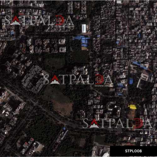
STPL008
30cm | Delhi
- Image projection: EPSG:32643 – WGS 84 / UTM zone 43N
- Cloud cover: 0%
- License: Vantor
- Radiometric resolution: Eight bit unsigned integer
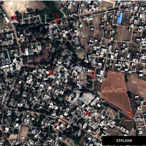
STPL009
15cm | Lucknow
- Image projection: EPSG:32644 – WGS 84 / UTM zone 44N
- Bands: 4
- License: Vantor
- Radiometric resolution: Sixteen bit unsigned integer
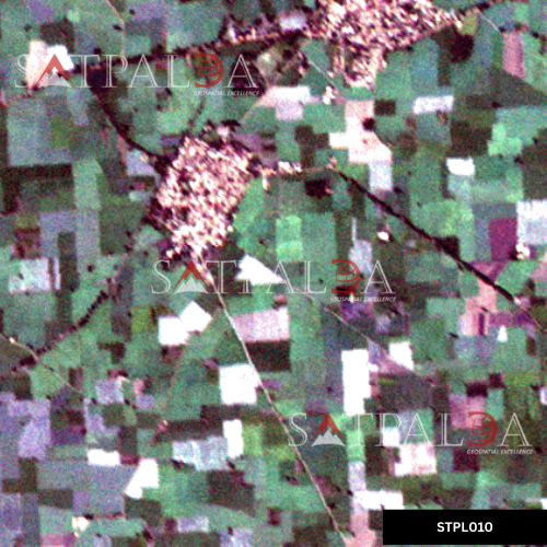
STPL010
5m | Punjab
- Image projection: EPSG:32643 – WGS 84 / UTM zone 43N
- Bands: 5
- Satellite name: Axelspace Grus 1 B
- Radiometric resolution: Sixteen bit unsigned integer
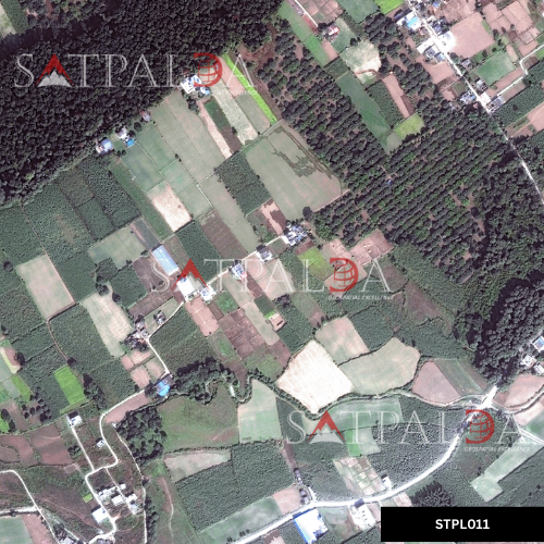
STPL011
50cm | Dehradun
- Image projection: EPSG:32643 – WGS 84 / UTM zone 43N
- Bands: 4
- Satellite name: Vantor Worldview 2
- Radiometric resolution: Sixteen bit unsigned integer
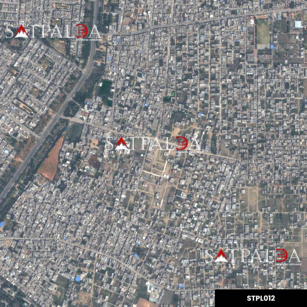
STPL012
50cm | Near Karnal | Stereo Image
- Image projection: EPSG:32643 – WGS 84 / UTM zone 43N
- Bands: 4
- Satellite name: Vantor Worldview 2
- Radiometric resolution: Sixteen bit unsigned integer
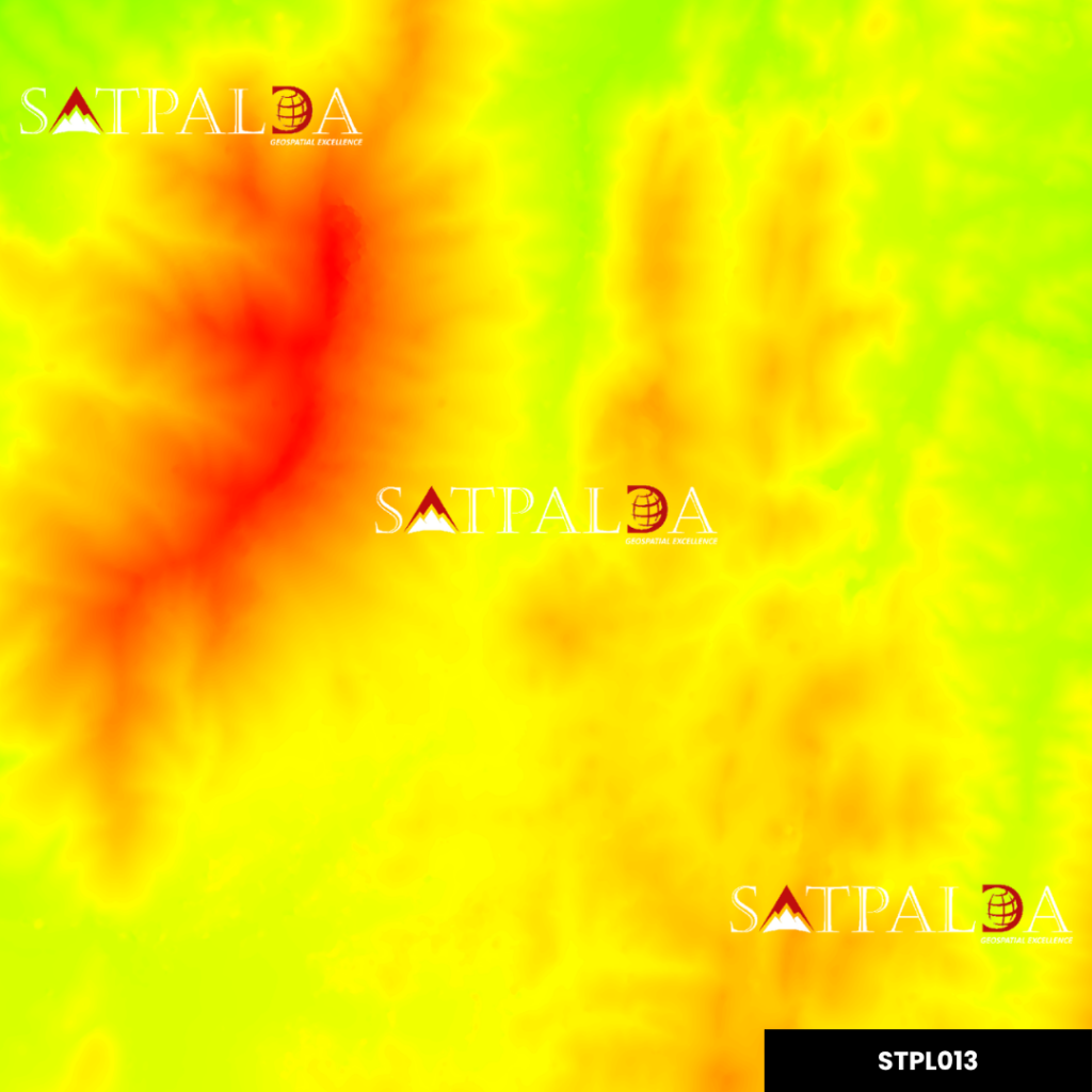
STPL013
50cm | Udaipur | DSM
- Image projection: EPSG:32643 – WGS 84 / UTM zone 43N
- Bands: 1
- Cloud cover: 0%
- Resolution: 50 cm
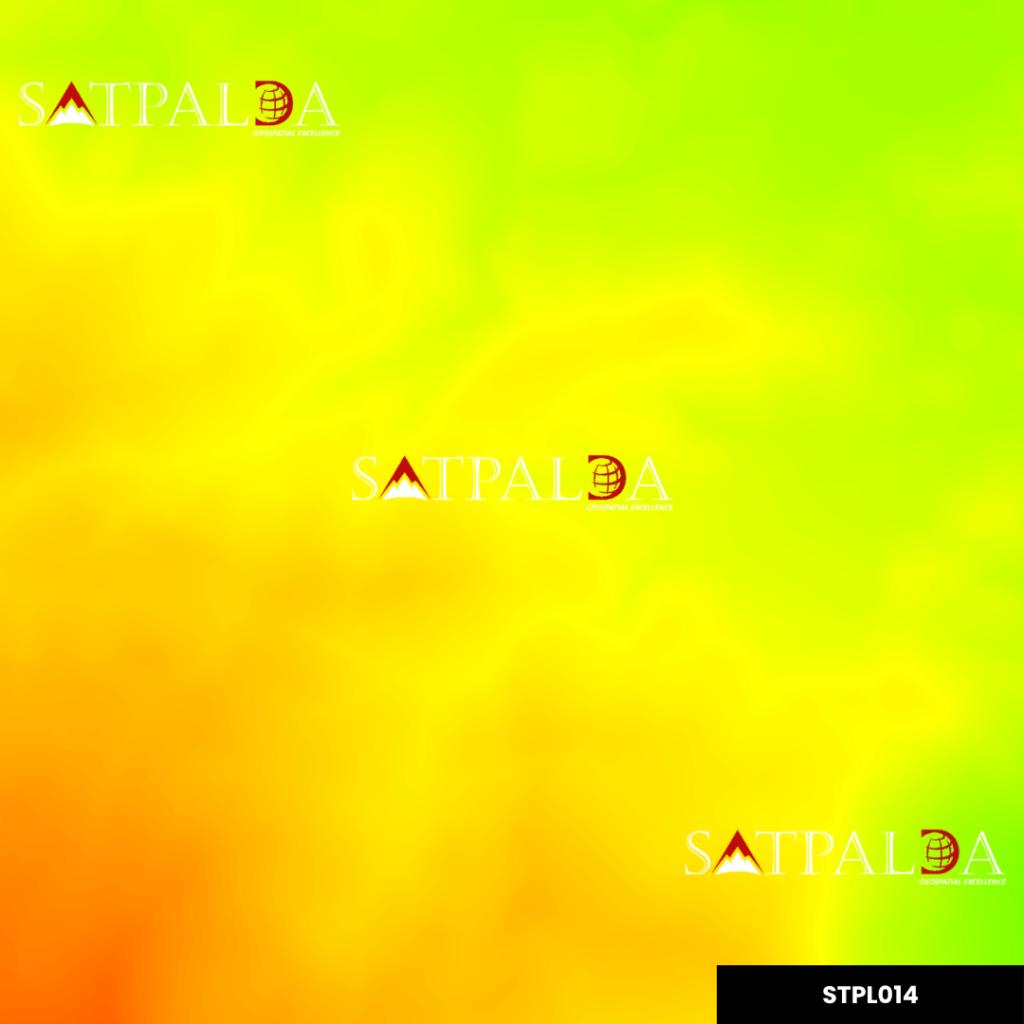
STPL014
1m | Wayanad | DTM
- Image projection: EPSG:32643 – WGS 84 / UTM zone 43N
- Bands: 1
- Cloud cover: 0%
- Resolution: 1 m