The Role of Satellite Data in National Security and Defense Planning
Modern defense strategies are increasingly dependent on satellite imagery and geospatial intelligence. In an era where information superiority can determine operational success, satellite-based Earth observation provides governments and defense organizations with critical insights into terrain, infrastructure, and real-time activities across the globe.
Satellite data enables continuous monitoring of large geographic areas, supports intelligence gathering, and enhances situational awareness for military planners and national security agencies. By integrating satellite imagery with geospatial analysis tools, defense institutions can make informed strategic decisions while minimizing risk and operational uncertainty.
As geopolitical dynamics evolve, the importance of satellite image analysis and geospatial intelligence (GEOINT) continues to grow, making satellite data a core component of modern defense planning.
Understanding Satellite Data in Defense Intelligence
Satellite data refers to imagery and sensor information captured by Earth observation satellites orbiting the planet. These satellites collect data using various technologies such as optical imaging, radar sensors, multispectral imaging, and thermal sensors.
For defense and national security agencies, this data becomes a powerful tool for understanding changes on the ground. Analysts interpret satellite images to detect infrastructure development, troop movements, equipment deployment, and environmental changes that could affect strategic planning.
Unlike traditional reconnaissance methods, satellite data provides large-scale coverage, high accuracy, and frequent updates, allowing intelligence teams to monitor developments even in remote or inaccessible regions.
Key Applications of Satellite Data in National Security
1. Border Surveillance and Monitoring
Border security remains a major priority for many countries. Satellite imagery allows authorities to monitor vast and difficult terrain such as deserts, mountains, forests, and coastlines.
Through satellite image analysis, security agencies can detect unauthorized crossings, infrastructure development near borders, and suspicious activities. Continuous monitoring ensures that potential threats can be identified early and addressed effectively.
Satellite data also supports border infrastructure planning by helping governments understand terrain conditions and environmental constraints.
2. Military Infrastructure Monitoring
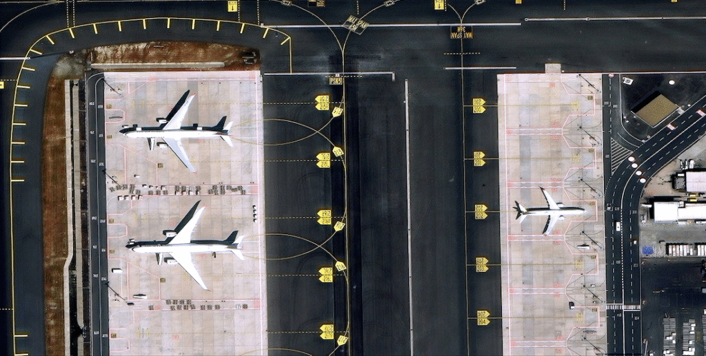
Satellite imagery plays a vital role in observing military installations and infrastructure development. Intelligence agencies use high-resolution satellite images to track construction of airfields, naval bases, missile sites, and defense facilities.
This information helps analysts assess military capabilities and identify emerging security concerns. Monitoring infrastructure changes over time can reveal patterns and strategic intentions, which are critical for defense preparedness.
Satellite monitoring provides insights without requiring direct physical presence in sensitive areas.
3. Strategic Terrain Analysis
Terrain plays a decisive role in military operations. Satellite imagery combined with geospatial analysis enables defense planners to evaluate terrain characteristics such as elevation, slope, vegetation, and accessibility.
Using digital elevation models and terrain analysis tools, military strategists can identify optimal routes, potential obstacles, and suitable locations for infrastructure development or deployment operations.
This type of analysis supports mission planning and helps reduce operational risks in unfamiliar environments.
4. Disaster Response and Humanitarian Security
National security agencies are often involved in disaster response and humanitarian operations. Satellite data allows authorities to quickly assess damage caused by natural disasters such as earthquakes, floods, wildfires, and cyclones.
Rapid satellite imagery analysis helps identify affected areas, damaged infrastructure, and population displacement. This information enables defense and emergency agencies to coordinate rescue operations, deliver aid, and restore critical infrastructure more efficiently.
Satellite-based monitoring also supports disaster preparedness by identifying high-risk regions and environmental vulnerabilities.
5. Maritime Security and Ocean Surveillance
Maritime security is essential for protecting national interests, trade routes, and offshore resources. Satellite imagery allows governments to monitor shipping routes, detect illegal fishing activities, and track suspicious vessels.
Synthetic Aperture Radar (SAR) satellites are particularly useful for maritime monitoring because they can capture images regardless of weather conditions or daylight availability.
Through satellite-based monitoring, security agencies gain better visibility of maritime activities and can respond quickly to potential threats.
6. Strategic Intelligence and Threat Assessment
Satellite data contributes significantly to strategic intelligence gathering. By analyzing satellite imagery over time, intelligence teams can identify patterns and trends related to military activity, infrastructure expansion, and geopolitical developments.
This intelligence supports long-term defense planning and policy decisions. Governments use satellite-based insights to evaluate potential threats, assess regional stability, and plan strategic initiatives.
When integrated with other intelligence sources, satellite data enhances the overall accuracy and reliability of national security assessments.
The Role of Geospatial Analysis in Defense
Satellite imagery alone provides valuable information, but its full potential is unlocked when combined with geospatial analysis techniques.
Geospatial analytics allows defense analysts to process large volumes of satellite data, identify spatial patterns, and extract actionable insights. Advanced GIS platforms enable visualization, modeling, and simulation of different operational scenarios.
Technologies such as artificial intelligence and machine learning are also being integrated into satellite image analysis to automate object detection, change detection, and anomaly identification.
These advancements are transforming how defense organizations process intelligence and respond to emerging threats.
The Future of Satellite Intelligence in Defense
The global demand for satellite-based intelligence continues to grow as governments seek better situational awareness and faster decision-making capabilities.
Emerging technologies such as high-resolution commercial satellites, real-time satellite monitoring, AI-powered analytics, and cloud-based geospatial platforms are making satellite intelligence more accessible and powerful.
Private sector satellite data providers and geospatial companies are also playing a significant role in supporting defense agencies with advanced imagery, analytics tools, and customized intelligence solutions.
As the Earth observation industry evolves, satellite data will remain a cornerstone of national security, enabling governments to monitor global developments and protect strategic interests.
Conclusion
Satellite data has become an essential component of modern national security and defense planning. By providing accurate, timely, and large-scale insights, satellite imagery empowers defense organizations to monitor borders, assess threats, analyze terrain, and respond to emergencies effectively.
With the integration of geospatial analysis, artificial intelligence, and advanced Earth observation technologies, satellite intelligence is transforming how governments approach security and strategic planning.
As global challenges continue to evolve, the role of satellite data in defense operations will only become more critical, shaping the future of intelligence and national security.


