From Space to Sea: SATPALDA Enabling Maritime Domain Awareness Through Satellite Imagery and Advanced Geospatial Analytics

Maritime Domain Awareness (MDA) has emerged as a critical capability for nations, port authorities, and maritime stakeholders to ensure security, safety, and sustainability across oceans and coastal regions. In an era where over 90 percent of global trade moves by sea, the ability to detect, understand, and respond to activities in the maritime domain using satellite imagery, geospatial services, and remote sensing technologies is no longer optional—it is strategic.
At its core, Maritime Domain Awareness is about situational awareness at sea: knowing which vessels are present, where they are operating, what they are doing, and whether their behaviour is compliant or anomalous. Achieving this level of awareness across vast oceanic spaces is only possible through the effective use of geospatial technology, including satellite remote sensing, GIS mapping, and satellite image analysis.
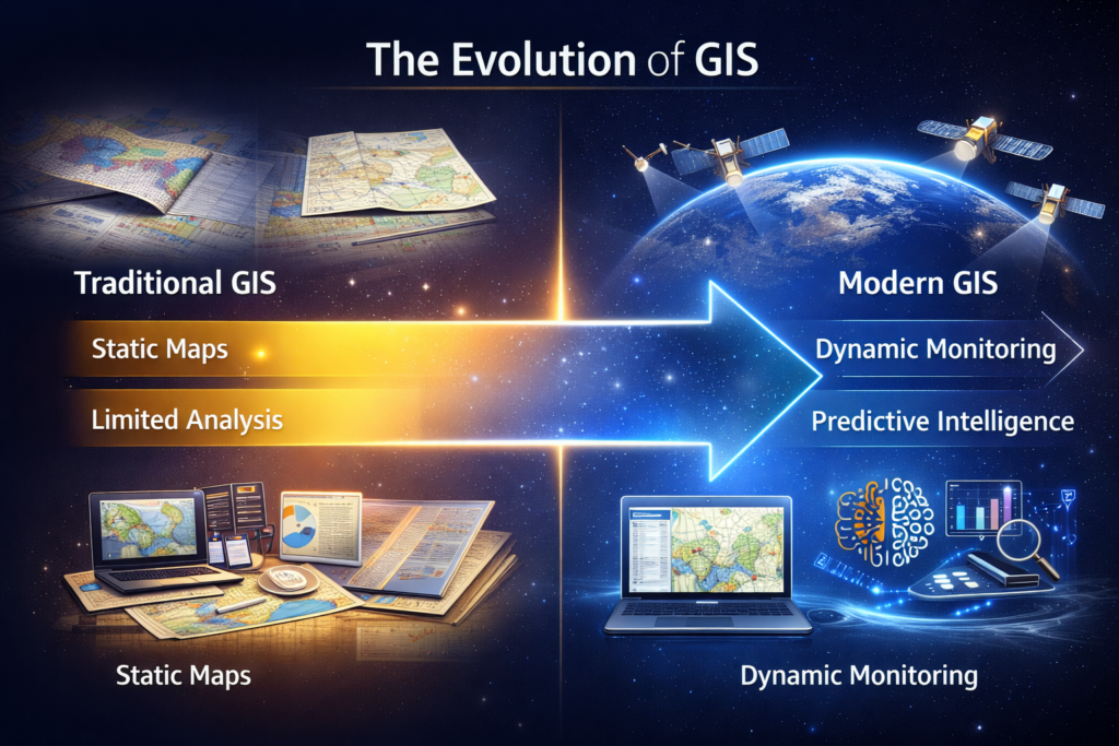
SATPALDA’s Geospatial Focus on Maritime Domain Awareness
At SATPALDA, we approach Maritime Domain Awareness as a geospatial intelligence and Earth observation challenge. Our solutions leverage high-resolution satellite imagery, SAR and optical satellite data, GIS-based analytics, and scalable geospatial platforms to support maritime security, compliance monitoring, and operational planning. By transforming raw satellite data and maritime geospatial information into actionable insights, SATPALDA enables stakeholders to move from reactive monitoring to proactive, intelligence-led decision-making.
The Role of Geospatial Intelligence in MDA
The maritime domain is inherently spatial and dynamic. Geospatial intelligence systems form the backbone of modern Maritime Domain Awareness by integrating diverse data sources into a single, actionable view. Satellite-based Earth observation, high-resolution satellite imagery, Geographic Information Systems (GIS), and advanced spatial analytics enable continuous maritime monitoring beyond the limitations of traditional coastal surveillance.
Key geospatial inputs include:
Satellite imagery (Optical and SAR): Wide-area detection of vessels using optical satellite imagery and Synthetic Aperture Radar (SAR), enabling identification of non-cooperative or “dark” vessels operating without AIS, even under cloud cover or at night.
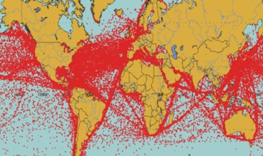
AIS and vessel tracking data: Time-series movement analysis using GIS-based analytics to understand vessel routes, operational behaviour, and maritime traffic patterns.
Radar and coastal sensors: High-frequency detection near ports, harbours, and sensitive coastal zones, supporting real-time maritime surveillance.
Oceanographic and weather data: Contextual geospatial layers integrated into GIS platforms to enhance navigation safety, risk assessment, and operational planning.
By fusing these datasets, geospatial platforms generate a Common Operating Picture (COP), allowing authorities to visualize real-time maritime activity and historical trends within a unified spatial data framework.
Advanced Analytics and Decision Support:
Modern Maritime Domain Awareness systems extend beyond visualization through geospatial analytics, AI-enabled GIS, and satellite image interpretation. These capabilities support:
Detection of anomalous vessel behaviour, including loitering, unusual speed changes, and suspicious rendezvous using temporal analysis of satellite data.
Identification of illegal, unreported, and unregulated (IUU) fishing, supported by SAR satellite images and vessel pattern analysis.
Monitoring of maritime boundaries, exclusion zones, and offshore infrastructure through continuous satellite-based surveillance.
Rapid response support for search and rescue operations and environmental incidents such as oil spills using remote sensing and GIS-based decision support systems.
These geospatially driven capabilities align with global best practices promoted by organizations such as the International Maritime Organization, emphasizing data-driven, cooperative maritime governance.
At its core, Maritime Domain Awareness is about situational awareness at sea: knowing which vessels are present, where they are operating, what they are doing, and whether their behaviour is compliant or anomalous. Achieving this level of awareness across vast oceanic spaces is only possible through the effective use of geospatial technology, including satellite remote sensing, GIS mapping, and satellite image analysis.
Conclusion:
As maritime activities grow in scale and complexity, geospatially enabled Maritime Domain Awareness will remain central to protecting global trade routes, coastal ecosystems, and national interests. The integration of satellite remote sensing, GIS, SAR imagery, and advanced analytics is no longer the future of MDA—it is the present. SATPALDA remains committed to delivering geospatial solutions and satellite-based intelligence that strengthen maritime awareness, resilience, and long-term sustainability.
Dr. Deepak Kumar Raj
Product Specialist | Satpalda