Satellite-Based Vegetation Health and Stress Monitoring Using NDVI and NDRE
Satellite-based vegetation health and stress monitoring offers a reliable way to assess crop and forest conditions across large and hard-to-access areas using high-resolution remote sensing imagery. By detecting changes in canopy color, structure, and moisture levels, satellite data helps identify early signs of vegetation stress caused by drought, pest activity, disease, or degraded soil conditions. This method provides consistent, repeatable, and objective observations that are not constrained by field access or local weather. The insights generated support timely, data-driven decisions, enabling farmers, foresters, and land managers to implement targeted interventions, enhance productivity, and minimize potential losses.
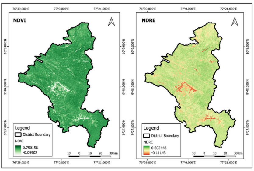
Satellite: Sentinel-2 (A/B)
Spatial Resolution: 10 meters
Time Period: 1 October 2024 – 28 February 2025
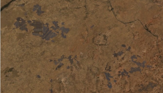
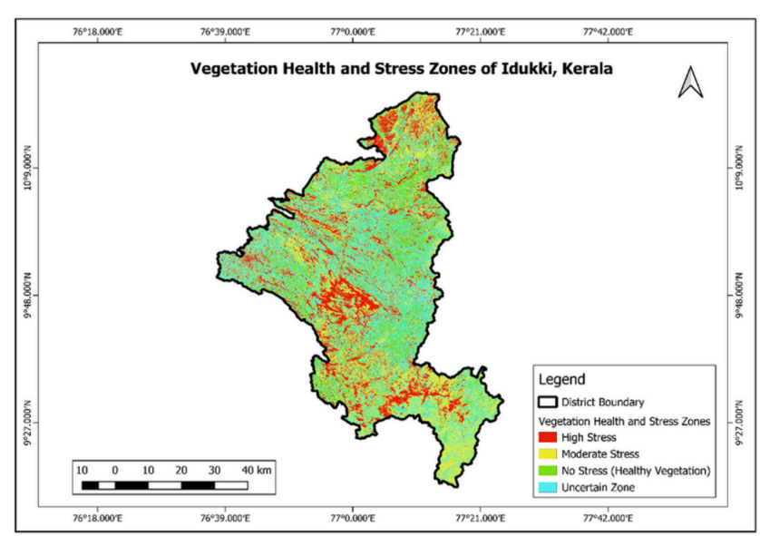
Area of Interest: Idukki, Kerala
Parameters Used:
NDVI (Normalized Difference Vegetation Index): Assesses vegetation vigor, greenness, and biomass
NDRE (Normalized Difference Red Edge Index): Indicates chlorophyll content and early-stage vegetation stress
Key Findings
Analysis of vegetation indices shows that Idukki district maintains predominantly healthy vegetation, particularly across forest-dominated western and northern regions. Areas of higher stress are concentrated in central and southeastern zones, corresponding with lower NDRE values. While NDVI indicates strong overall greenness, NDRE reveals early-stage vegetation stress more effectively. Plantation and agricultural belts display greater variability, reflecting sensitivity to moisture availability and nutrient conditions. Combined NDVI–NDRE mapping confirms that NDRE is better suited for early stress detection, while NDVI captures general vegetation vigor. Overall, vegetation health remains strong, with localized stress zones requiring focused attention.
Conclusion
Satellite-based vegetation monitoring using NDVI and NDRE provides valuable insights into plant health and early stress conditions. By combining these indices with remote sensing data, land managers can detect localized risks early, prioritize interventions, and support sustainable agriculture and forest management practices.
Amit Thakur
GIS Engineer