X-Band and L-Band SAR: Applications, Advantages, and Satpalda’s Role in SAR Intelligence
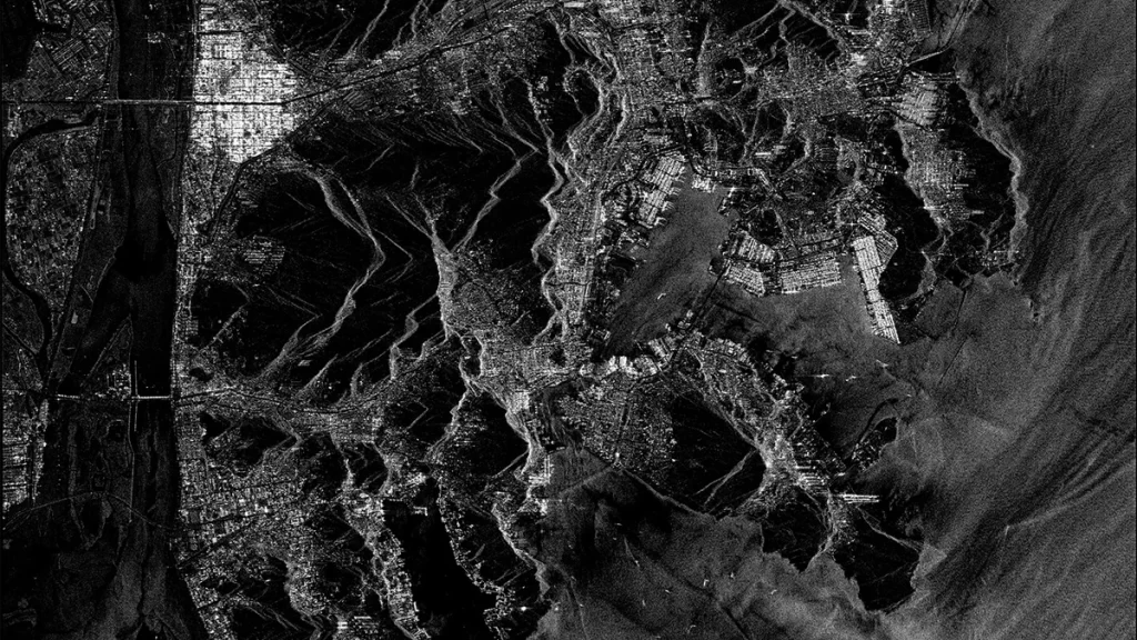
Image rights: Synspective
Introduction
Synthetic Aperture Radar (SAR) uses microwave signals to capture images of the Earth’s surface, allowing it to operate day and night and through clouds or smoke. By analysing the radar pulses that return from the ground, SAR produces detailed 2D and 3D views of natural and built features. Its ability to penetrate vegetation and soil—depending on the wavelength—makes it reliable for consistent environmental monitoring. SAR commonly operates in X-band, C-band, L-band, S-band, and P-band, each offering different levels of detail and penetration. Higher-frequency bands provide sharper imagery, while lower-frequency bands are better for observing features beneath vegetation and surface layers.
Importance of X and L band
X-band is valued for its short wavelength, which enables it to capture fine surface features with exceptional clarity. This makes X-band highly sensitive to small objects, sharp edges, and subtle changes on the ground. As a result, it is widely used in urban and infrastructure monitoring, where detecting small-scale features such as buildings, roads, and engineering structures is essential.
L-band, with its longer waves, can penetrate vegetation, dry soil, and even snow to some extent, enabling the radar signal to interact with deeper layers of the surface. This makes L-band an excellent choice for forestry, agriculture, and land surface studies where understanding conditions beneath the canopy is crucial. L-band also maintains coherence over longer periods, especially in vegetated or rural regions, making it valuable for long-term ground deformation monitoring, landslide analysis, and geological studies. Its ability to capture large-scale structural changes and penetrate complex surfaces gives L-band a unique advantage in environmental and earth science applications.
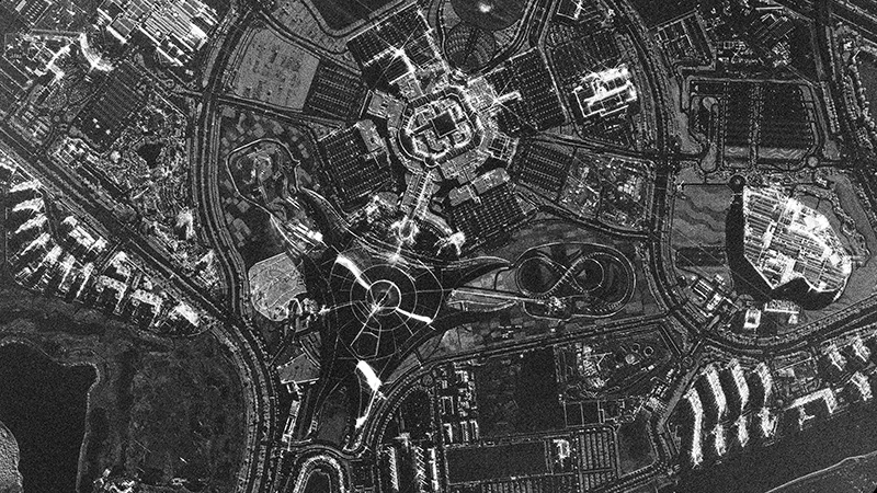
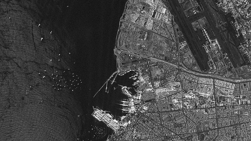
Image rights: Synspective
Uses of X-Band SAR data
X-band SAR is best suited for applications that demand high spatial detail and precise surface interpretation. Its short wavelength captures fine textures, sharp edges, and small objects, making it ideal for high-resolution urban mapping. Cities rely on X-band data for detailed city mapping, urban growth analysis, and monitoring changes in built-up areas. This level of detail also supports rapid disaster assessment, where authorities need to identify collapsed structures, landslide boundaries, or debris patterns immediately after an event. X-band is highly effective for 3D model generation using techniques like InSAR and stereo SAR to produce accurate Digital Surface Models (DSMs) and Digital Terrain Models (DTMs).
X-band SAR also plays a significant role in defence and security applications due to its sensitivity to small surface features allows for object detection, target recognition, and surveillance. The capability to image under all weather conditions makes it particularly valuable for tactical and strategic monitoring. Additionally, X-band SAR is used in coastal and maritime monitoring, including ship detection, port monitoring, and shoreline mapping. Its high resolution enables the identification of small vessels and detailed coastal features.
Uses of L-Band SAR data
L-band SAR, with its longer wavelength and deeper penetration capability, excels in applications involving vegetation, soil, and natural landscapes. Forestry agencies use L-band to map forest structure, estimate biomass, and detect logging activities, as it captures reflections from tree trunks and ground layers that shorter wavelengths cannot reach. In agriculture, L-band helps monitor crop growth, soil moisture, and waterlogging even when fields are fully covered by vegetation. Its stable coherence in rural and vegetated areas also makes it ideal for long-term ground deformation studies, including landslide tracking, volcanic monitoring, and tectonic movement analysis. L-band’s interaction with deeper surface layers also supports geological mapping, revealing subsurface features, soil characteristics, and terrain changes that are often invisible in optical or high-frequency radar data.
Role of Satpalda
Satpalda is playing a key role in expanding access to high-resolution SAR data by partnering with Synspective, a leading X-band SAR satellite operator. Through this collaboration, Satpalda acts as a regional geospatial solutions provider that connects end users with Synspective’s advanced SAR imagery and value-added products. Satpalda streamlines data acquisition, handles technical coordination, and ensures that users receive the most suitable SAR datasets for their specific applications. By integrating Synspective’s all-weather, high-frequency radar observations into its own processing and analytical workflows, Satpalda delivers ready-to-use geospatial insights for infrastructure monitoring, disaster assessment, urban analysis, and environmental management. This partnership enables organizations to easily adopt SAR-based decision-making without dealing with the complexities of satellite tasking and data handling.
Conclusion
X-band SAR has emerged as a powerful tool for high-precision, high-resolution Earth observation, offering unmatched value for sectors that rely on detailed, dependable, and weather-independent imaging. Satpalda’s collaboration with Synspective ensures that this advanced radar capability is not only accessible but also transformed into meaningful, application-ready intelligence. By simplifying data access, enhancing analytical workflows, and tailoring outputs to user needs, Satpalda plays a pivotal role in bringing the full potential of X-band SAR technology to governments, industries, and research organisations. This partnership ultimately empowers users to make faster, more informed decisions using robust SAR-driven insights.
Sanchita Maitri
GIS Engineer