


.png)


.png)
.png)


.png)


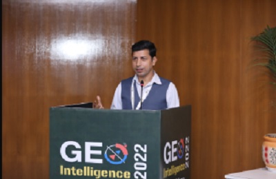
Geo-Intelligence at New Delhi
Thank you for attending the 12th edition of the Geointelligence conference 2022 hosted by the Geospatial world. The two days event was successfully completed at Ambedkar Centre New Delhi. The conference’s theme was Geospatial Strategy for Defence and Security. The main aim was to discuss the use of geospatial in strategic warfare and modern-day challenges on the battlefield that can be tackled through Geo-intelligence. The event was also highlighted by the many defence professionals who talked about increased Geopolitical churnings. These have aggravated the threat scenario, the increasing use of UAVs and drones in modern warfare, and how the boundaries between two nations are blurred by the new tech.
Major Highlights from the Conference:
Day 1
Day one was highlighted by a Plenary event focused on topics like Geospatial Strategy for Defense and Security Geo4IR for National Security Geospatial to modern cyber security threats The plenary event was followed by three sessions on Persistent & Resilient Space4ISR Capability, Geospatial Infrastructure for Informatized Warfighting, and SpaceCom4Military Space Based Communication for Informatized Battlefield. Key points: The exploitation of the space domain sets the pace for battlefield transparency. High bandwidth downlinks, laser communications as well as inter-satellite links will significantly overcome some of the defence issues in terms of getting information from the satellites. Geospatial Technology Infrastructure Development is taking place at a very fast pace.
There is a need to have a policy at the top and large professional agencies have to interpret and integrate the systems to achieve targeting accuracy at a tri-service level.
Space-based communication has seen rapid development in technology, reduction in cost and increase in participation by private industry i.e. helping nations innovate and strive for battlefield dominance.
The geographical operating spread of defence forces especially in the maritime domain has made space-based communication and surveillance the backbone of network operations.
Day 2
Day two was also highlighted by the session on defence and space track and various people from different backgrounds presented their research and findings. Key Points that were discussed are Changing environment in defence and security with enabling of geospatial tools and real-time data monitoring. AI in transforming defence and security operations. Maritime domain awareness.
An industry user meets also held which discussed the Internal Security & Public Safety Issue. Mr Yashwant Singh, International Business and Geospatial Expert of SATPALDA also addressed the event on the role of GIS in Disaster Management.