.png)


.png)
.png)


.png)


Correlator3D
SimActive’s Correlator3D™ software is a photogrammetry solution for the generation of high-quality geospatial data from satellite and aerial imagery, including UAVs. Powered by GPU technology and multi-core CPUs, Correlator3D™ ensures matchless processing power to support rapid production of large datasets.
Correlator3D™ performs aerial triangulation (AT) and generates the following outputs:
- Digital surface models (DSM)
- Digital terrain models (DTM)
- Point clouds
- Orthomosaics
- Vectorized 3D features
- Mosaic Creation & Editing
- Feature Extraction
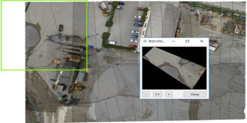
Outputs generated after Aerial Triangulation in Correlator3D
The Simactive software provides advanced editing tools such as point cloud colorization, GCP creation, volume calculation, 3D Feature Extraction and NDVI map creation. The launch and advancements in the Simactive software Correlator3D served widespread applications in agriculture, emergency response, surveying and environmental monitoring. The software is primarily used for performing watershed analysis on collected database of aerial images. The ability to quickly and easily generate digital surface models (DSM) will allow the Department of Agriculture to significantly reduce costs of watershed analysis compared to traditional survey methods or LiDAR data.
Simactive Correlator3D Workflow
- Project Creation: The user is first requested to select the type of data to be processed. The project type has to selected from UAV , medium/large format, satellite, ADS, and A3 ( for super large frames).
- Automated Workflow: Once a project is created, the automated workflow can be used to automatically process the data according the selected profile.
- Project Startup
- Image Selection: The images to be processed must first be selected. If the image files do not include exterior orientation data (EXIF), a text file must be imported. A projection system must be specified
- Camera parameters: In most cases, the camera parameters will be automatically determined by the software. Values for the focal length, principal point, pixel. Size and distortion can also be manually set.
- Project Parameters: The project location on the PC must be specified. Optionally, a ground control point (GCP) file can be created or referenced orthophotos can be imported.
Correlator3D Unique Benefits
- Simple and user friendly interface
- Unlimited number of images
- Survey-grade accuracy with detailed report
- Fast processing on GPUs and multi-core CPUs
Aerial Triangulation
Aerial Triangulation allows calibrating the camera and refining exterior orientation parameters. The accuracy of AT results depends on the quality of the subsequent DSM, DTM, point clouds and orthomosaics. The AT toolbar contains direct access to all AT steps, which should be performed in the following sequential order:
 Allows creating GCPs, which ensures absolute accuracy of the final results
 Automatically extracts tie points between the images
 Provide manual tie point creation for the user
  Performs bundle adjustment to calibrate the camera & adjust the exterior orientation of each image
 Filters AT results by removing images with a tie point residual higher than a specified threshold
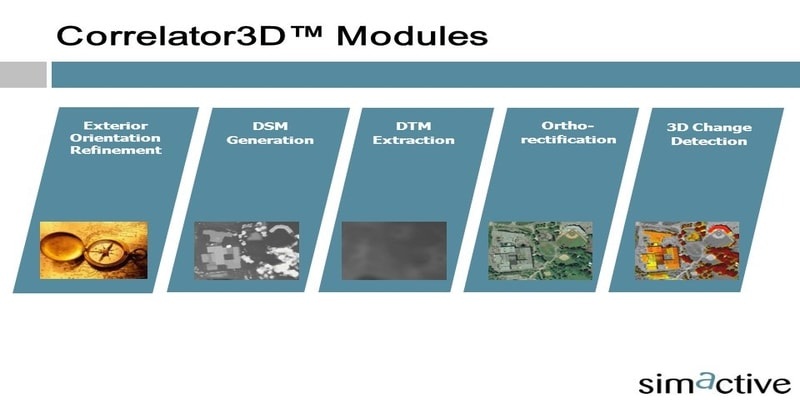
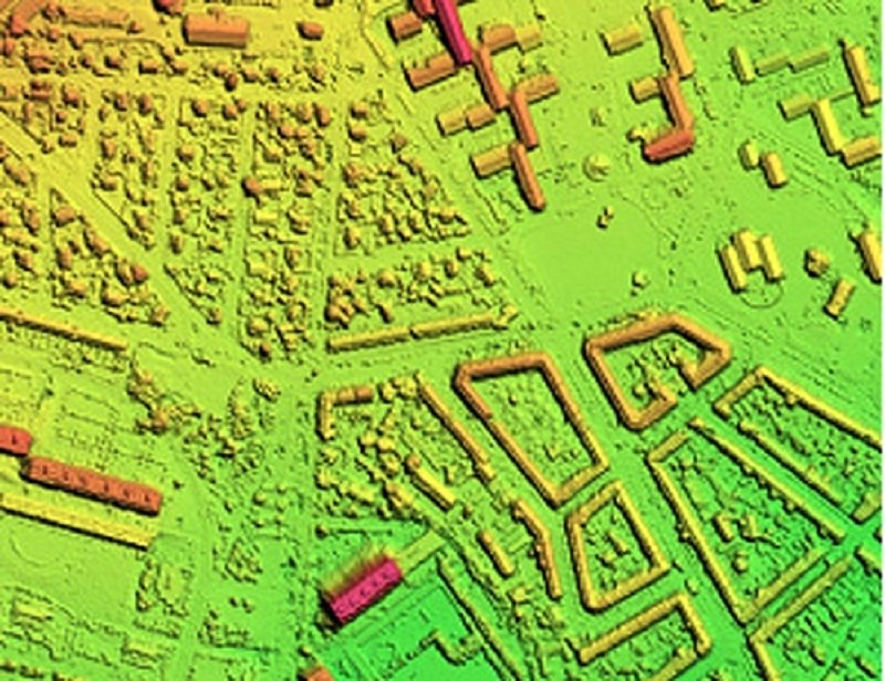
DSM Generation
After AT, a DSM is to be generated at the output resolution specified by the user during which elevation information is derived from the overlapping regions between successive images used as stereo data.
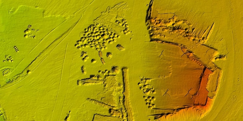
DTM Extraction
A DTM can be extracted through automatic filtering of the DSM by analyzing the DSM and removing the structures on the ground by the image processing software. DTMs are useful for generating orthophotos as they avoid visual artifacts (e.g. along building edges) caused by using DSMs.
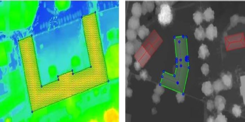
DEM Editing
The DEM editing module is the group of operations required to be done to make alteration on the DSMs/DTMs by selecting a polygonal selection and performing operations such as crop/delete, set/offset elevation values and filter regions. For quick removal of structures,
‘Delete and Fill’ function is also available.
Orthorectification
Orthorectification consists of geometrically correcting the raw images such that they provide an accurate representation of the ground surface. The photos are thus adjusted for topographic relief, lens distortion and camera orientation.
Mosaic Creation
The individual orthophotos generated are merged to obtain a unique image covering the entire area. In order to provide seamless transition between the adjacent images composing the mosaic, the software automatically selects the portion of the orthorectified image to be kept in the final mosaic along with performing seamline generation and color balancing.
The mosaic editing module allows to modify seamlines with real-time visual feedback on the effect of changes. It can also be used for tuning the global mosaic colors and to enhance its appearance. After editing is completed, the mosaic is exported following a tiling scheme defined by the user.
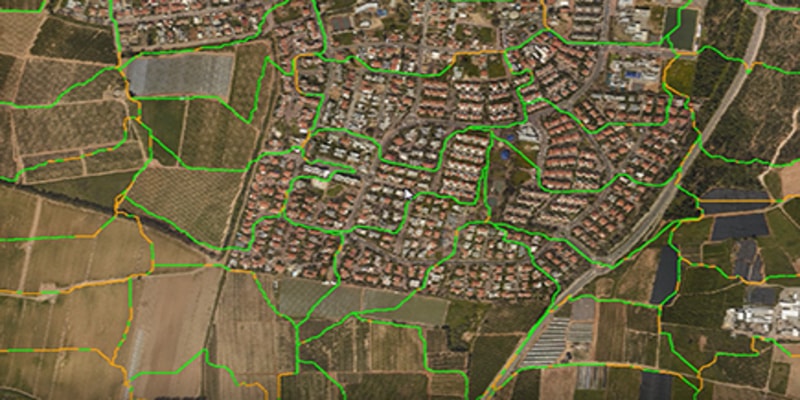
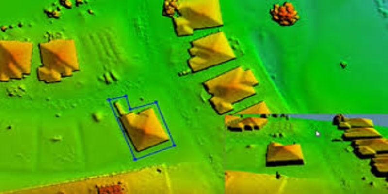
The feature extraction module generates 3D features from a DSM by creating 3D polygons. It consists of a semi-automatic tool that uses photogrammetric/LiDAR DSMs and extracts objects such as buildings, roads, waterbodies and forests.
Correlator3D has been designed to operate on standard PCs. However, it consists of state –of-the-art software and as such, requires a recent computer. A great portion of the processing is performed directly on the graphics card which enables Correlator3D to generate geospatial data so rapidly. The supported cards must feature an NVIDIA GeoForce graphics processor.