


.png)


.png)
.png)


.png)


Geosmart India 2022 at HICC, Hyderabad
SATPALDA@GeosmartIndia_2022 Thanks to everyone who participated and made GeoSmart India 2022(15-17 Nov 2022) a grand success. The event was hosted by the Geospatial World and co-hosted by the Indian Society of Remote Sensing and the Indian Society of Geomatics. The aim of this event was to discuss the most challenging socio-economic issues hindering growth; facilitate networking among the geospatial community consisting of government, mapping agencies, researchers, academics, private industries, and users of geospatial information. Key Points Geospatial information has emerged as a critical tool for the country’s development. From the bottom up, the nation is moving toward a sustainable development era with the goals of reducing poverty, addressing climate change, and raising economic and living standards. The government issued geospatial data guidelines, paving the way for its use in various industries. The country is experiencing a severe water crisis that is turning into a critical issue, and the government has taken several initiatives to solve the problem. The need for water, particularly clean water, has reached an all-time high. The three-day summit was attended by over 2500 participants from 500 government and corporate organizations that work with geospatial technology and data.
Day 1 at GeoSmart India Shri Gajendra Singh Shekhawat, Union Jal Shakti Minister, launched the GeoSmart India 2022 Summit in Hyderabad and stated that the country is at the forefront of a new wave of socioeconomic prosperity powered by cutting-edge technology and innovation. The collection, production, and dissemination of geospatial data have been democratized.
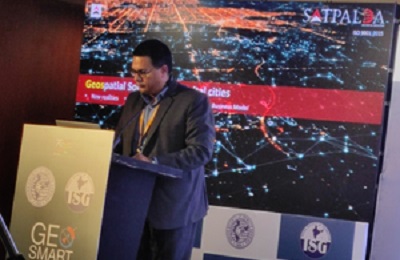
Day 2 at GeoSmart India Amit Seymour, Director of SATPALDA addressed the event on the topic “Towards Smart & spatially connected Governance”. He gave an overview of the company and services provided by the company focusing particularly on Smart city strategies such as smart city planning and redesigning, redevelopment, retrofitting, and greenfield He also shared Digital Twin, Property Tax Evasion using GIS, and Water Resource Management: Utility, Risk and Prevention
Day 3 at GeoSmart India Our International Business Specialist and Geospatial Expert, Mr. Yashwant Singh, spoke on “Geospatial Data and Services for Water Resource Management.” It was followed by a demonstration on “Modern Technologies in Linear Infrastructure/Railways” by Nikhil Saini, Business Development Manager. Our network expanded as we met with more geospatial professionals on day three as well.