7 Must-Know Use Cases of Satellite Data in Agriculture You Can’t Ignore
Agriculture is no longer just about soil, water, and weather—it’s about data-driven decision-making. With increasing pressure to improve productivity while managing limited resources, farmers and agribusinesses are turning to satellite data in agriculture to gain a competitive advantage.
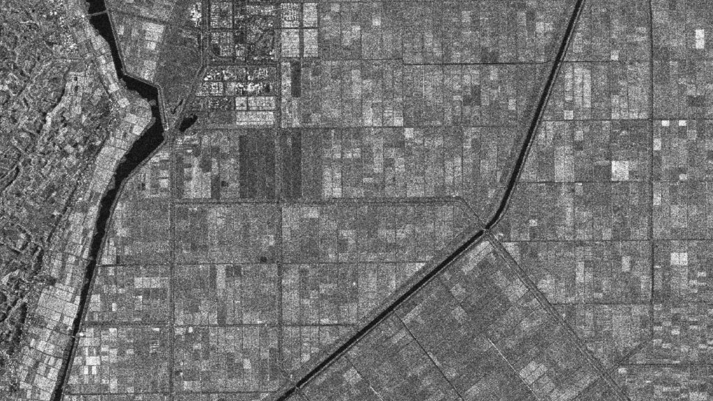
Using satellite imagery, remote sensing, and GIS mapping, modern agriculture is becoming smarter, more efficient, and highly optimized. From monitoring crop health to predicting yields, satellite-based insights are transforming how farming is done across the world.
Here are seven powerful use cases of satellite data in agriculture that are reshaping the industry.
1. Crop Health Monitoring Using Satellite Imagery
One of the most important applications of satellite imagery in agriculture is monitoring crop health.
Using vegetation indices such as NDVI (Normalized Difference Vegetation Index), satellite data helps detect:
- Crop stress
- Nutrient deficiencies
- Pest infestations
- Water stress
Farmers can identify problem areas early and take corrective actions before damage spreads. This improves productivity and reduces losses significantly.
2. Precision Agriculture and Smart Farming
Precision agriculture is all about applying the right input at the right place and time. Satellite data enables farmers to divide fields into zones and manage them individually.
With GIS and geospatial analytics, farmers can:
- Optimize fertilizer usage
- Improve irrigation efficiency
- Reduce chemical usage
- Enhance crop productivity
This targeted approach leads to better yields while minimizing environmental impact.
3. Crop Yield Prediction and Forecasting
Accurate yield prediction is critical for supply chain planning and market forecasting.
Using satellite data and remote sensing analysis, analysts can estimate crop yield based on:
- Vegetation health
- Weather patterns
- Soil conditions
- Historical data
Governments and agribusinesses use this information to plan storage, pricing, and distribution strategies.
4. Soil Moisture and Irrigation Management
Efficient water management is one of the biggest challenges in agriculture. Satellite imagery helps monitor soil moisture levels and optimize irrigation.
With satellite-based insights, farmers can:
- Identify dry and over-irrigated areas
- Plan irrigation schedules
- Reduce water wastage
This is especially useful in regions facing water scarcity, where efficient resource use is critical.
5. Land Use and Crop Classification
Satellite imagery plays a key role in land use and land cover (LULC) mapping and crop classification.
Using multispectral satellite data, analysts can:
- Identify different crop types
- Monitor crop rotation patterns
- Track agricultural land use changes
This information is valuable for governments, insurance companies, and agricultural planners.
6. Disaster Monitoring and Risk Management
Agriculture is highly vulnerable to natural disasters such as droughts, floods, and storms.
Satellite data enables real-time monitoring of agricultural risks, helping farmers and authorities:
- Assess damage quickly
- Identify affected areas
- Plan recovery strategies
For example, satellite imagery can detect drought conditions early, allowing farmers to adjust planting strategies accordingly.
7. Farm Planning and Resource Optimization
Satellite imagery supports better farm planning and resource management.
Farmers and agricultural organizations can use geospatial data to:
- Analyze terrain and soil conditions
- Plan crop selection
- Optimize land usage
- Improve long-term farm productivity
By combining satellite data with GIS tools, decision-making becomes more accurate and efficient.
Why Satellite Data is Transforming Agriculture
The adoption of satellite data in agriculture is increasing rapidly due to several advantages:
- Large-scale monitoring of farmland
- Frequent updates through satellite revisits
- Cost-effective alternative to field surveys
- Accurate and unbiased data
- Integration with AI and geospatial analytics
With advancements in Earth observation technology, farmers now have access to actionable insights that were previously unavailable.
The Future of Agriculture with Satellite Data
The future of agriculture lies in data-driven and technology-enabled farming.
Emerging trends include:
- AI-powered crop monitoring
- Real-time satellite analytics
- Integration with IoT-based smart farming systems
- Climate-resilient agricultural planning
These innovations will further enhance the role of satellite imagery and geospatial intelligence in agriculture.
Conclusion
Satellite data is revolutionizing agriculture by providing farmers with accurate, timely, and actionable insights.
From crop monitoring and yield prediction to irrigation management and disaster response, the applications of satellite imagery are vast and impactful.
By leveraging satellite data, GIS mapping, and remote sensing technologies, agriculture is becoming more efficient, sustainable, and resilient.
As the demand for food continues to grow, adopting satellite-based agriculture solutions will be essential for ensuring productivity and sustainability in the years to come.


