8 Powerful Benefits of Hyperspectral Satellite Imagery You Should Know
In the world of satellite imagery and remote sensing, not all data is created equal. While traditional optical and multispectral imagery provide valuable insights, they often fall short when deeper, more detailed analysis is required. This is where hyperspectral satellite imagery comes in.
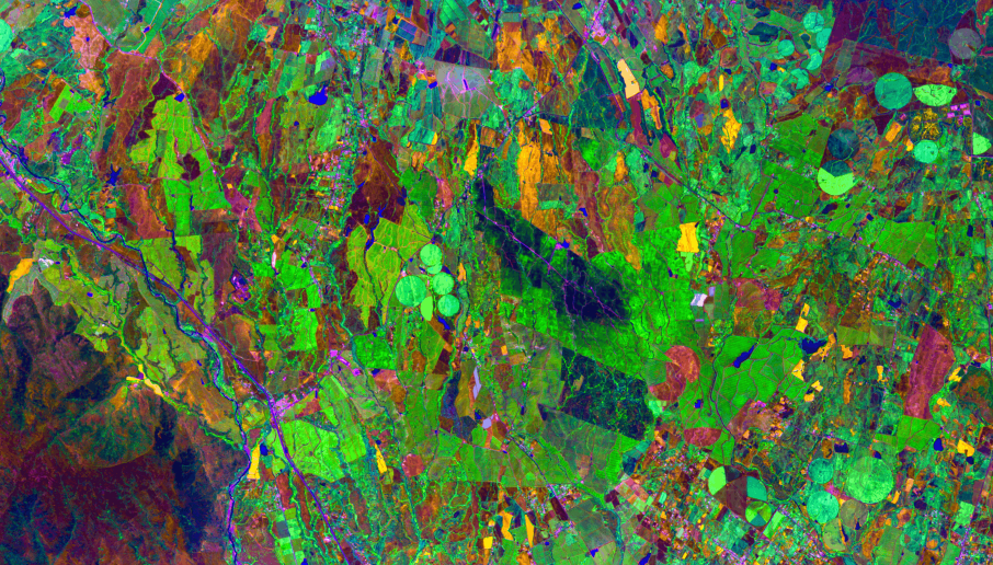
Unlike conventional satellite imagery, hyperspectral imaging captures data across hundreds of narrow spectral bands. This allows analysts to detect subtle differences in materials, vegetation, and surface composition that are invisible to the human eye.
From precision agriculture and mineral exploration to environmental monitoring, hyperspectral satellite imagery is transforming geospatial intelligence. Here are eight powerful benefits that make it a game-changing technology.
1. Detailed Material Identification
One of the biggest advantages of hyperspectral satellite imagery is its ability to identify materials with high accuracy.
Each material reflects light differently across the electromagnetic spectrum. Hyperspectral sensors capture these unique spectral signatures, allowing analysts to:
- Distinguish between different minerals
- Identify soil composition
- Detect pollutants and contaminants
This level of detail is unmatched by traditional satellite imagery.
2. Advanced Mineral and Resource Exploration
Hyperspectral imagery is widely used in mining and natural resource exploration.
By analyzing spectral signatures, geospatial experts can:
- Detect mineral deposits
- Map geological formations
- Identify potential mining zones
This reduces the need for expensive ground surveys and accelerates exploration processes.
3. Improved Agricultural Monitoring
In agriculture, hyperspectral data enables high-precision crop monitoring.
Farmers and agribusinesses can use hyperspectral imagery to:
- Detect crop stress early
- Identify nutrient deficiencies
- Monitor plant health at a granular level
This supports precision agriculture, helping improve yield and optimize resource usage.
4. Enhanced Environmental Monitoring
Environmental monitoring becomes significantly more accurate with hyperspectral satellite imagery.
It helps in:
- Detecting water pollution
- Monitoring deforestation
- Identifying soil degradation
- Tracking climate-related changes
Governments and environmental agencies rely on hyperspectral data for sustainable resource management.
5. Detection of Hidden and Subtle Features
Unlike standard satellite imagery, hyperspectral imaging can reveal hidden or subtle features.
This includes:
- Underground mineral variations
- Moisture content in soil
- Chemical composition of surfaces
Such insights are critical for industries that require deep surface analysis.
6. Better Classification and Mapping Accuracy
Hyperspectral data improves land use and land cover (LULC) classification accuracy.
With hundreds of spectral bands, analysts can:
- Differentiate similar-looking land features
- Improve mapping precision
- Enhance GIS-based analysis
This leads to more reliable geospatial datasets for planning and decision-making.
7. Supports AI and Advanced Analytics
Hyperspectral satellite imagery works exceptionally well with AI and machine learning models.
These technologies can process large volumes of hyperspectral data to:
- Automate feature detection
- Improve classification accuracy
- Generate predictive insights
This combination of AI and hyperspectral analytics is shaping the future of geospatial intelligence.
8. Wide Range of Industry Applications
The versatility of hyperspectral imagery makes it useful across multiple industries, including:
- Agriculture – Crop health and yield optimization
- Mining – Mineral detection and exploration
- Environmental Monitoring – Pollution and climate analysis
- Defence – Target detection and surveillance
- Urban Planning – Land use analysis
Its ability to provide detailed and actionable insights makes it a valuable tool for modern industries.
Why Hyperspectral Imagery is the Future
The demand for high-resolution and high-accuracy satellite data is growing rapidly. Hyperspectral imagery meets this demand by offering:
- Greater spectral detail
- Improved analytical capabilities
- Enhanced decision-making support
With advancements in satellite technology and cloud-based processing, hyperspectral data is becoming more accessible than ever.
Conclusion
Hyperspectral satellite imagery is redefining the possibilities of remote sensing and geospatial analytics.
By providing unmatched detail and precision, it enables industries to make smarter, faster, and more informed decisions. Whether it’s detecting minerals, monitoring crops, or analyzing environmental changes, hyperspectral imagery offers capabilities that go far beyond traditional satellite data.
As technology continues to evolve, hyperspectral imaging will play a crucial role in shaping the future of satellite imagery, GIS, and geospatial intelligence.
For businesses looking to gain deeper insights and stay ahead of the competition, adopting hyperspectral satellite imagery is no longer optional—it’s a strategic advantage.


