What Is Satellite Imagery? Definition, Types, and Applications
Satellite imagery has transformed the way we observe, analyze, and understand our planet. From weather forecasting and disaster management to agriculture and urban planning, satellite images provide critical insights that help governments, businesses, researchers, and organizations make informed decisions. In today’s data-driven world, satellite imagery serves as one of the most valuable sources of geospatial intelligence, enabling users to monitor vast geographic areas quickly and accurately.
If you’ve ever viewed your house on an online map, tracked a hurricane’s movement, or seen before-and-after images of a natural disaster, you’ve already experienced the power of satellite imagery. However, the technology behind these images extends far beyond visualization. Modern Earth observation satellites continuously collect data about land, oceans, atmosphere, vegetation, and infrastructure, creating a detailed digital record of our changing planet.
Understanding what is satellite imagery is essential for anyone interested in geospatial technologies, remote sensing, environmental monitoring, or location-based decision-making.
Satellite Imagery Definition: Understanding the Basics
To understand the true value of this technology, it is important to begin with a clear satellite imagery definition.
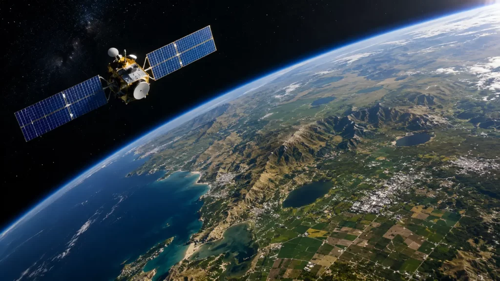
Satellite imagery refers to images of the Earth’s surface captured by sensors mounted on satellites orbiting the planet. These sensors detect reflected or emitted electromagnetic energy from the Earth’s surface and convert that information into visual images and data products.
Unlike traditional photography, satellite imagery can capture information beyond what the human eye can see. Depending on the sensor type, satellites can collect data in visible, infrared, thermal, and microwave wavelengths. This capability allows analysts to identify vegetation health, monitor temperature variations, assess water conditions, detect land-use changes, and observe environmental phenomena that would otherwise remain invisible.
The quality and usefulness of satellite imagery depend on several factors, including spatial resolution, temporal resolution, spectral resolution, and revisit frequency. Modern commercial satellites can capture imagery with resolutions measuring less than one meter, enabling detailed analysis of buildings, roads, and other infrastructure.
Today, thousands of satellites operate in orbit, continuously gathering imagery that supports applications ranging from scientific research to commercial intelligence and national security.
Types of Satellite Imagery and How They Differ
Not all satellite imagery is created equal. Different sensors are designed to capture specific types of information depending on the intended application.
Optical satellite imagery is the most familiar type and closely resembles traditional aerial photography. It captures reflected sunlight in visible wavelengths and produces images that are easy for humans to interpret. Optical imagery is widely used for mapping, urban planning, agriculture, and environmental monitoring.
Multispectral imagery captures data across multiple spectral bands, including visible and near-infrared wavelengths. This allows analysts to assess vegetation health, monitor crop conditions, and identify environmental changes that may not be visible in standard photographs.
Hyperspectral imagery takes this concept even further by collecting information across hundreds of spectral bands. This level of detail supports advanced applications such as mineral exploration, environmental assessment, and precision agriculture.
One of the most powerful forms of satellite imagery is Synthetic Aperture Radar (SAR) imagery. Unlike optical sensors, SAR systems actively emit microwave signals and measure their return from the Earth’s surface. This enables imaging regardless of cloud cover, weather conditions, or darkness. SAR imagery plays a critical role in disaster response, infrastructure monitoring, and maritime surveillance.
Thermal imagery captures heat emissions from the Earth’s surface and is commonly used for wildfire monitoring, urban heat analysis, and environmental studies.
Each imagery type provides unique insights, and many organizations combine multiple datasets to create a comprehensive understanding of geographic conditions.
Remote Sensing and Satellite Imagery: Understanding the Connection
The terms remote sensing and satellite imagery are often used together, but they are not identical concepts.
Remote sensing is the broader scientific discipline of collecting information about an object, area, or phenomenon without direct physical contact. Satellite imagery is one of the most widely used outputs of remote sensing technology.
Remote sensing data can be acquired from satellites, aircraft, drones, LiDAR systems, and other sensor platforms. Satellite imagery represents a specific category of remotely sensed data collected from orbiting satellites.
The relationship between remote sensing and satellite imagery has become increasingly important as organizations seek real-time insights into environmental, economic, and infrastructure-related changes. Remote sensing techniques enable analysts to process raw satellite data into actionable information that supports decision-making.
For example, environmental agencies use remote sensing workflows to monitor deforestation, track climate change impacts, and assess ecosystem health. Agricultural organizations rely on remotely sensed satellite imagery to evaluate crop conditions, identify stress areas, and optimize farming practices.
The integration of advanced analytics, artificial intelligence, and cloud computing has further expanded the capabilities of remote sensing and satellite imagery, enabling faster and more accurate geospatial intelligence generation.
Application of Satellite Imagery Across Industries
The growing availability of high-resolution Earth observation data has significantly expanded the application of satellite imagery across industries.
In agriculture, satellite imagery supports precision farming by helping farmers monitor crop health, assess irrigation requirements, detect disease outbreaks, and optimize resource utilization. Regular imagery updates enable data-driven decisions that improve productivity and reduce costs.
Disaster management agencies use satellite imagery to monitor floods, wildfires, earthquakes, hurricanes, and other natural hazards. During emergencies, satellite data provides rapid situational awareness that helps responders assess damage, identify affected populations, and coordinate relief efforts.
Urban planners and government agencies use satellite imagery to monitor urban growth, analyze land-use changes, plan infrastructure projects, and support smart city initiatives. The ability to track development over time helps authorities make informed planning decisions.
Environmental organizations rely on satellite imagery for forest monitoring, biodiversity assessment, water resource management, and climate change research. Large-scale environmental changes that would be difficult to measure through ground surveys can be observed efficiently from space.
Infrastructure companies use satellite imagery to monitor roads, railways, pipelines, power networks, and construction projects. Regular monitoring helps identify risks, detect changes, and improve asset management practices.
In defense and security applications, satellite imagery supports intelligence gathering, border monitoring, maritime surveillance, and strategic planning. Governments worldwide depend on Earth observation capabilities to maintain situational awareness and support national security objectives.
As satellite constellations continue to grow and imagery becomes more accessible, new applications continue to emerge across virtually every sector of the global economy.
Conclusion
Understanding what is satellite imagery provides valuable insight into one of the most important technologies shaping modern geospatial intelligence. Through advanced sensors orbiting the Earth, satellite imagery enables organizations to observe, monitor, and analyze geographic conditions on an unprecedented scale.
From the fundamental satellite imagery definition to advanced applications involving agriculture, disaster management, environmental monitoring, infrastructure management, and defense, the value of Earth observation data continues to expand. The close relationship between remote sensing and satellite imagery has created powerful opportunities for organizations to transform geographic data into actionable intelligence.
As technology advances and access to imagery improves, the application of satellite imagery will continue to drive innovation, support informed decision-making, and help solve some of the world’s most complex challenges.
FAQs
Satellite imagery refers to images of the Earth's surface captured by sensors mounted on orbiting satellites. These images provide valuable information for mapping, monitoring, analysis, and decision-making.
Satellite imagery is a product generated through remote sensing. Remote sensing is the broader science of collecting information about objects or areas without direct physical contact.
The main types include optical imagery, multispectral imagery, hyperspectral imagery, thermal imagery, and Synthetic Aperture Radar (SAR) imagery.
Satellite imagery is used in agriculture, disaster management, urban planning, environmental monitoring, infrastructure management, defense, and scientific research.
Satellite imagery provides large-scale, accurate, and frequently updated geographic information that helps organizations monitor changes, assess risks, and make informed decisions.


