Assessing Flood Vulnerability in Lakhimpur, Assam via DSM/DTM Heights Extrusion
A Geospatial Framework for 3D Building Hazard Mapping, Early Disaster Mitigation & Urban Zoning Assessing Flood Vulnerability in Lakhimpur, Assam via DSM/DTM Heights Extrusion A Geospatial Framework for 3D Building Hazard Mapping, Early Disaster Mitigation & Urban Zoning.
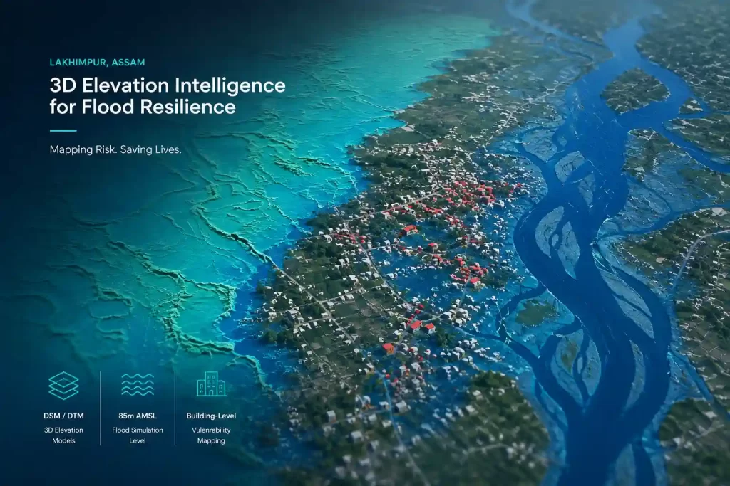
STUDY REGION :-
Lakhimpur District, Assam
SIMULATED FLOOD THRESHOLD:-
85 meters AMSL
PRIMARY SPATIAL DATASETS:-
DSM, DTM & nDSM (Height Extrusion)
Executive Summary & Geospatial Context
Lakhimpur district in Assam is situated along the northern bank of the Brahmaputra River, surrounded by the Eastern Himalayan foothills. Characterized by high seasonal rainfall and dynamic riverine networks, the region experiences recurring severe flooding. Traditional 2D flood vulnerability maps often fail to capture individual structure risk because they treat urban footprints as flat ground.
By leveraging high-resolution Digital Surface Models (DSM) and Digital Terrain Models (DTM), this dataset provides a micro-topographic framework to simulate inundation profiles. Subtracting the DTM from the DSM isolates normalized above-ground features (nDSM), enabling 3D height extrusion of buildings. When placed on simulated water levels (specifically evaluated at 85 meters above mean sea level), this methodology pinpointed individual vulnerable structures, differentiated bare-ground runoff from urban channelization, and established spatial boundaries for disaster preparedness and urban construction regulation.
Elevation Modeling: Comparative Analysis of DSM vs. DTM
Understanding surface dynamics during a deluge requires separating raw terrain topography from surface obstacles:
- DSMDSM Digital Surface Model: Captures the top surface of the environment, including ground elevation, building heights, infrastructure, tree canopies, and micro-barriers. In inundation modeling, DSM reflects how real-world surface obstacles divert, impound, or channelize floodwaters.
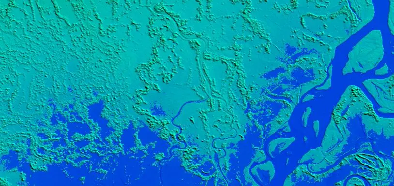
- DTMDTM Digital Terrain Model: Filters out all natural and man-made non-ground features, leaving bare-earth elevation contours. DTM is essential for modeling natural hydrological flow paths, regional slope gradients, and baseline water accumulation.
- nDSMnDSM Normalized Digital Surface Model (Extrusion): Calculated as nDSM = DSM − DTM. This mathematical derivation strips away bare ground, yielding absolute heights of buildings and vegetation above ground level.
| Dataset Layer | Surface Representation | Hydrological Role in Flood Simulation |
|---|---|---|
| Digital Surface Model (DSM) | Bare earth + Buildings + Trees + Bridges | Models micro-barriers, urban impoundment, and obstacle-induced backwater effects. |
| Digital Terrain Model (DTM) | Bare ground surface only | Defines regional gravity-driven flow paths, flood plain extent, and baseline water depth. |
| Height Extrusion Layer (nDSM) | Isolated 3D object geometry & heights | Evaluates structural plinth height against water level to confirm building inundation. |
DSM
DTM
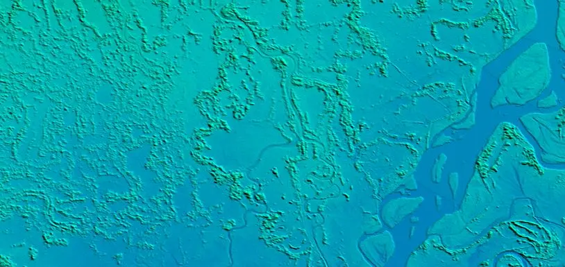
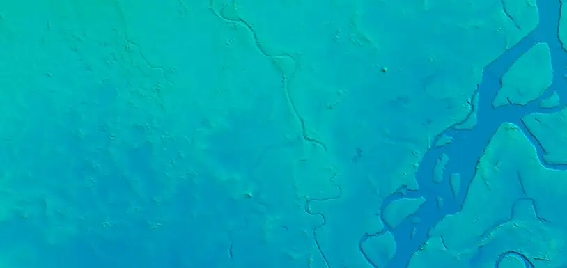
FLOOD SIMULATION DYNAMICS AT 85 METERS AMSL
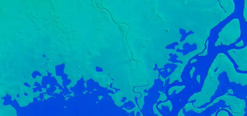
The visual dataset assesses inundation under a benchmark flood scenario of 85 meters above mean sea level (AMSL). The comparative visual results highlight critical hydrodynamic differences:
- Bare-Earth Overland Inundation (DTM Simulation): The DTM flooding model illustrates unobstructed water spread across the alluvial plain. Low-lying corridors and river channels fill rapidly, demonstrating pure topographic susceptibility without urban influence.
- Micro-Topographic Flow Channelization (DSM Simulation): The DSM flooding model reflects realistic urban flood behavior. Densely clustered structures, road embankments, and boundary walls act as localized dams and diverters. Water accumulates heavily along narrow lanes and behind structural barriers, raising local water depth beyond theoretical bare-ground projections.
Key Insight from 85m AMSL Simulation
Comparing bare-ground (DTM) versus surface-feature (DSM) flooding demonstrates that urban structures do not merely suffer flood damage—they actively modify water flow paths. Ignoring building height extrusions leads to underestimating localized water accumulation in high-density settlements.Key Insight from 85m AMSL SimulationComparing bare-ground (DTM) versus surface-feature (DSM) flooding demonstrates that urban structures do not merely suffer flood damage—they actively modify water flow paths. Ignoring building height extrusions leads to underestimating localized water accumulation in high-density settlements.
DSM Flooding
DTM Flooding
BUILDING EXTRUSION & MICRO-LEVEL VULNERABILITY IDENTIFICATION
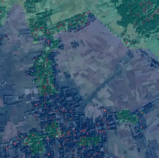
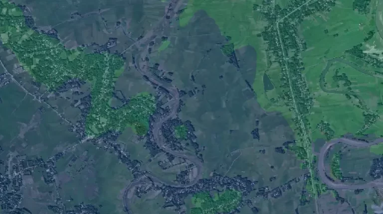
By overlaying high-resolution satellite imagery with extracted 3D building heights on the DTM elevation base, individual structural footprints susceptible to 85m AMSL flooding were mapped precisely:
- Individual Structure Extrusion: Extruding 3D building polygons from nDSM provides the exact elevation of foundation ground levels and single- vs. multi-story structural heights.
- Structural Hazard Categorization: Buildings whose base ground elevation falls below 85m AMSL and whose height extrusion is lower than simulated flood depth are flagged as high-risk, completely submerged structures.
- Precise Spatial Marking: Vulnerable structures are identified in red footprint markers on the satellite spatial canvas, isolating specific residential clusters in Lakhimpur that require immediate emergency prioritization.
OPERATIONAL APPLICATIONS FOR DISASTER MANAGEMENT & URBAN PLANNING
Early Disaster Response & Evacuation Logistics
- Traditional disaster response operates on broad regional alerts. With 3D building-level hazard maps, local authorities in Lakhimpur can transition to pinpointed early action:
- Targeted Evacuation Protocols: Identify specific households vulnerable to inundation prior to severe monsoonal discharges, directing emergency vehicles along un-flooded DSM access corridors.
- Shelter Allocation: Identify multi-story elevated structures or high-ground relief zones that will remain dry above the 85m AMSL inundation surface.
Proactive Risk-Informed Urban Zoning & Construction Regulation
Beyond immediate disaster response, 3D elevation modeling serves as a critical foundation for spatial planning and climate resilience:
- No-Build Conservation Zones: Establish legally enforced “no-construction” buffers in low-lying depressions and natural flood paths below the 85m AMSL threshold.
- Mandatory Plinth Height Regulations: Enforce building codes requiring foundation plinths to exceed peak simulated flood heights for all new constructions in moderate-risk zones.
- Resilient Infrastructure Design: Optimize urban drainage channels and elevated road embankments based on DSM surface obstacle dynamics.
CONCLUSION
Integrating high-resolution DSM and DTM elevation datasets with 3D building height extrusion converts raw elevation data into actionable spatial intelligence. For flood-prone regions like Lakhimpur, Assam, this methodology enables disaster managers and urban planners to move from reactive flood response to proactive hazard mitigation, safeguarding lives and guiding sustainable infrastructure development.
Himansh Ameta
GIS Intern