Mumbai’s Urban Transformation (2011–2025)
Satellite imagery reveals fourteen years of urban densification, infrastructure development, and housing transformation in Mumbai.
Overview
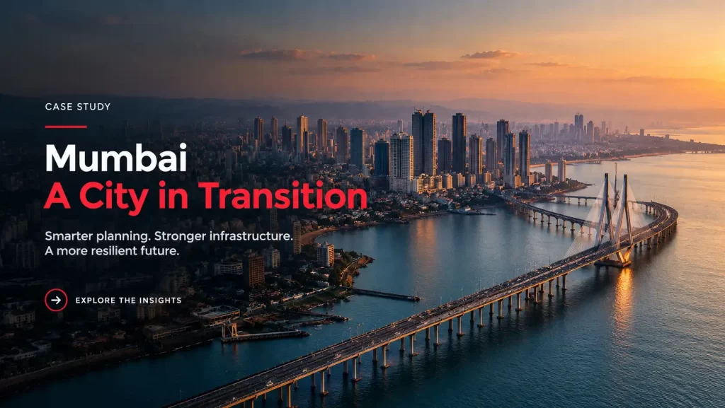
Mumbai is bounded by the sea and faces intense population pressure, limiting opportunities for outward expansion. This case study examines how the city has adapted to these constraints through vertical development, infrastructure expansion, and housing redevelopment.
The assessment compares 44 satellite images across 11 locations in Mumbai, captured at four points in time: 2011, 2015, 2020 and 2025. By analysing rooftop patterns, building footprints, construction activity, coastal boundaries, and transport corridors, the study identifies three major forces reshaping the city’s urban landscape: neighbourhood densification, large-scale infrastructure development, and the consolidation and rehabilitation of informal settlements.
Study Approach
Each of the 11 locations was interpreted as a four-frame satellite imagery time series covering 2011, 2015, 2020 and 2025. Observed changes were examined at both macro and micro scales to understand how urban development evolved across the study period.
At the macro level, the assessment focused on land-use changes, infrastructure corridors, and coastal boundaries. At the micro level, it examined rooftop materials, plot consolidation, and construction stages. These observations were then interpreted in relation to the planning processes shaping Mumbai’s urban transformation.
Informal Settlement Densification at the Mangrove Edge
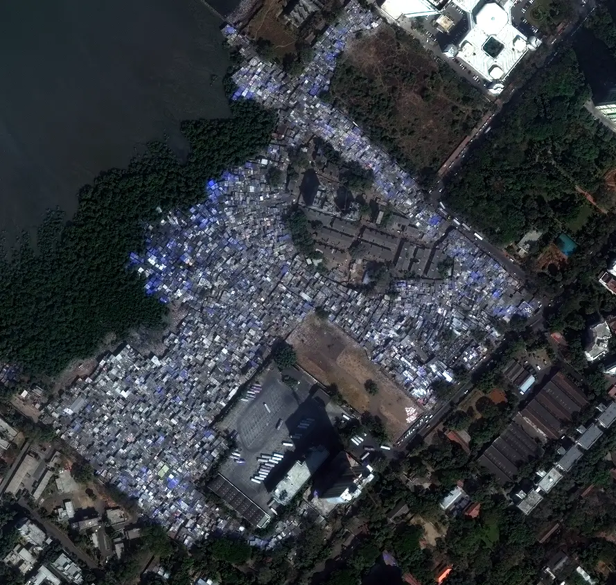
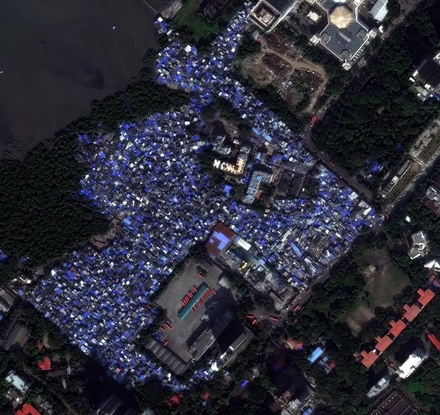
This informal settlement is located against an ecological boundary of mangroves and tidal inlets. Between 2011 and 2025, the area transformed from a relatively open and mixed settlement pattern into a tightly consolidated residential fabric.
Blue polyethylene sheeting, initially used for seasonal monsoon waterproofing, became increasingly widespread across rooftops. By 2025, internal lanes were no longer clearly visible from above, and the settlement had expanded up to the protected mangrove boundary.
Planning Interpretation
Rather than undergoing formal redevelopment, the settlement adapted through self-built vertical accretion. The widespread use of tarpaulin roofing reflects a low-cost response to flood vulnerability and illustrates the limited space remaining for further expansion.
Verticalisation and Real Estate Capitalisation
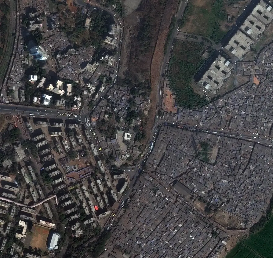
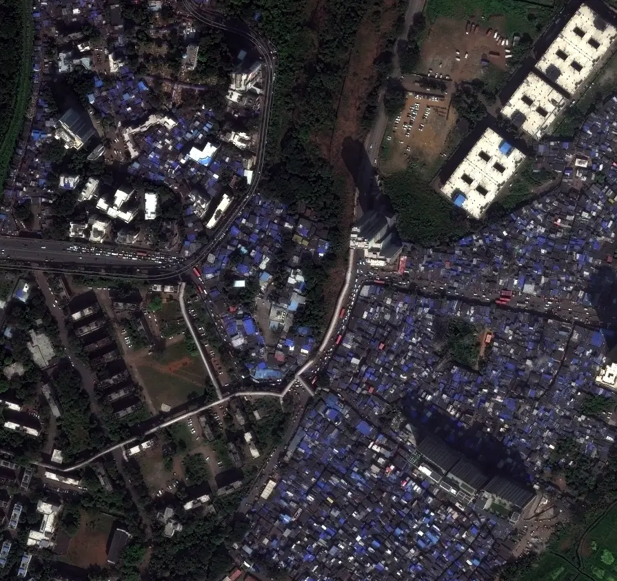
An older mixed-use neighbourhood characterised by low-rise chawls underwent significant redevelopment during the study period. From approximately 2015, plots were consolidated and cleared, with foundation pits and tower cranes indicating the beginning of large-scale construction.
By 2020, concrete cores reaching approximately 30–40 storeys were emerging alongside remaining informal residential pockets. By 2025, completed high-rise towers had transformed the skyline, creating a sharp contrast between modern developments and the surrounding low-rise urban fabric.
Planning Interpretation
Increasing land values and market pressure have driven plot consolidation and vertical rebuilding, allowing more intensive use of available floor space. This redevelopment has created a fragmented skyline that reflects spatial inequality while placing additional pressure on local infrastructure and utilities.
Design instructions
Use the same layout and slider dimensions as Section 4. Keep the image carousel at full content width and place the interpretation in a separate Text Editor widget beneath it.
Formal Slum Rehabilitation and Vertical Resettlement
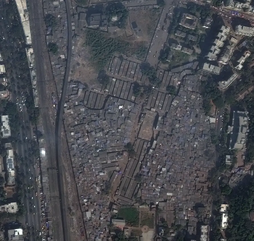
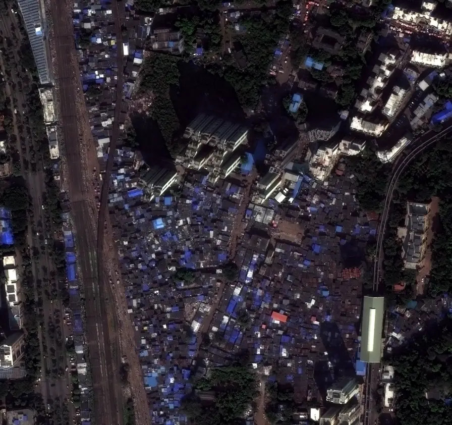
In a densely populated low-rise residential sector, formal rehabilitation gradually replaced horizontal settlement patterns with high-density residential towers.
By 2015, a parcel had been cleared for temporary transit housing to accommodate residents during redevelopment. By 2020, deep excavation and rising concrete frames indicated active construction. By 2025, completed rehabilitation towers had replaced the earlier settlement layout, representing a transition from horizontal to vertical residential density.
Planning Interpretation
The Slum Rehabilitation Authority (SRA) model accommodates existing residents in high-density residential towers while allowing a portion of the land to be used for commercial development. This cross-subsidisation approach supports rehabilitation while enabling more intensive utilisation of scarce urban land.
Design instructions
Keep the same layout as the previous two featured sections. The sequence should remain:
Heading → Description → Satellite Image Slider → Caption → Planning Interpretation
Infrastructure and Land-Use Change Across the Study Area
The remaining locations demonstrate how Mumbai continues to increase urban capacity without significantly expanding its available land. Satellite imagery reveals the transformation of industrial areas, transportation networks, coastal corridors, and planned urban districts.
These changes reflect the growing importance of infrastructure modernisation, efficient land utilisation, and vertically integrated development in a geographically constrained megacity.
| Development Theme | What the Satellite Imagery Shows | Planning Interpretation |
|---|---|---|
| Brownfield Revitalisation | Open storage yards and low-efficiency industrial land are cleared, graded, and paved into high-capacity logistics platforms. | Existing industrial sites can be upgraded to increase freight capacity without requiring additional land. |
| Linear Transit Insertion | Low-rise warehouses give way to cleared corridors, supporting piers, and elevated road segments. | Vertically layered transport networks help overcome limited horizontal space. |
| Mass-Transit Depots | A low-intensity rail yard evolves into an excavation site and eventually an operational maintenance depot. | Large contiguous parcels support the development of essential mass-transit infrastructure. |
| Marine and Coastal Corridors | Waterfront and sea-link construction extends transportation infrastructure across water. | Marine engineering provides additional connectivity where land acquisition is constrained. |
| Master-Planned Districts | Vacant parcels and surface parking areas are converted into corporate, institutional, and mixed-use developments. | High land values encourage more intensive development and the relocation of parking underground. |
Key Takeaways
The multi-temporal satellite imagery analysis highlights three important trends shaping Mumbai’s urban transformation between 2011 and 2025.
Mumbai Grows Up and Through, Not Out
Hover to explore ↗Vertical development and layered transportation corridors allow Mumbai to increase urban capacity despite limited opportunities for outward expansion. High-rise construction and infrastructure modernisation are reshaping the city's built environment.
Public and Private Development Operate in Parallel
Hover to explore ↗Public investment supports transit systems and coastal infrastructure, while market-driven redevelopment transforms industrial land and older residential neighbourhoods into logistics facilities and high-rise developments.
Housing Density and Environmental Pressures Remain Significant
Hover to explore ↗Informal settlements continue to become denser, while formal rehabilitation projects introduce vertical housing solutions. These patterns demonstrate the need for inclusive planning that integrates housing development, infrastructure provision, and climate resilience.
Conclusion
Mumbai’s urban transformation between 2011 and 2025 demonstrates how a land-constrained megacity responds to increasing population pressure, infrastructure requirements, and housing demand.
The analysis of 44 satellite images across 11 locations reveals the combined influence of vertical redevelopment, infrastructure expansion, informal settlement consolidation, and formal housing rehabilitation. Together, these transformations illustrate a city balancing economic development ambitions with the practical challenges of limited land, spatial inequality, and environmental vulnerability.
Multi-temporal satellite imagery provides a valuable perspective on these changes, helping urban planners and decision-makers understand the evolution of the built environment and the planning considerations associated with future urban development.
Himansh Ameta
GIS Engineer