How to Access Free Satellite Imagery: Best Sources and Platforms
Satellite imagery has become one of the most valuable sources of geospatial information available today. Governments, researchers, businesses, students, and GIS professionals use satellite data for applications ranging from environmental monitoring and agriculture to urban planning, infrastructure management, and disaster response. While high-resolution commercial imagery can be expensive, a significant amount of Earth observation data is available at no cost through various public platforms and satellite programs.
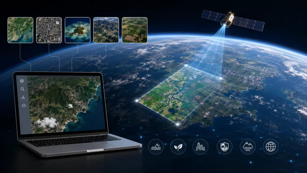
The increasing availability of free satellite imagery has transformed the geospatial industry by making remote sensing data accessible to a much wider audience. What once required costly subscriptions and specialized access can now be downloaded directly from online platforms in just a few clicks.
Whether you are a GIS analyst, researcher, student, or decision-maker, understanding where to access free imagery and how to use it effectively can significantly improve your geospatial workflows. Fortunately, multiple organizations around the world provide open-access satellite data that supports a wide range of professional and academic applications.
Why Free Satellite Imagery Has Become So Important
Over the past decade, the Earth observation industry has undergone a major shift toward open data initiatives. Organizations such as NASA, the European Space Agency (ESA), and various national space agencies have recognized the value of making satellite data publicly available.
The availability of free satellite imagery has accelerated research, innovation, and decision-making across numerous sectors. Agricultural organizations use satellite imagery to monitor crop health and optimize farming operations. Environmental agencies track deforestation, water resources, and climate change impacts. Urban planners analyze land-use changes and infrastructure growth. Disaster management agencies rely on satellite data for rapid damage assessment and emergency response planning.
One of the biggest advantages of open-access satellite imagery is the ability to monitor large geographic areas consistently over time. Historical image archives allow users to study environmental changes, urban expansion, and infrastructure development spanning decades.
As cloud-based geospatial platforms continue to evolve, access to free satellite imagery is becoming easier than ever before, enabling organizations of all sizes to benefit from Earth observation technologies.
Best Platforms to Download Satellite Imagery
One of the most common requirements among GIS professionals and researchers is the ability to download satellite imagery for analysis and mapping projects. Several trusted platforms provide direct access to large satellite image archives.
USGS EarthExplorer
EarthExplorer is one of the most widely used sources for satellite imagery worldwide. Managed by the United States Geological Survey (USGS), it provides access to Landsat imagery, aerial photography, digital elevation models, and various geospatial datasets. The platform offers decades of historical Earth observation data that can be downloaded for free.
Copernicus Data Space Ecosystem
The European Union’s Copernicus program provides access to Sentinel satellite imagery, including optical and radar datasets. Sentinel satellites are widely used for agriculture, environmental monitoring, land-use analysis, and disaster management applications.
NASA Earthdata offers access to a vast collection of satellite products related to climate, atmosphere, land cover, oceans, and environmental monitoring. Researchers frequently use these datasets for scientific analysis and Earth system studies.
Although Google Earth Engine is primarily a cloud-based analysis platform rather than a direct download portal, it provides access to massive satellite imagery archives that can be processed and exported for research and GIS projects.
These platforms have become foundational resources for professionals seeking reliable and accessible satellite imagery.
Free Real-Time Satellite Imagery: What Is Actually Available?
Many users search for free real time satellite imagery, expecting live video-like views of the Earth from space. In reality, truly real-time satellite imagery is relatively rare because satellites require time to capture, process, transmit, and distribute data.
However, several platforms provide imagery with very short update intervals that effectively function as near real-time Earth observation systems.
Weather satellite networks operated by agencies such as NOAA and EUMETSAT provide imagery updates every few minutes for atmospheric monitoring and storm tracking. These systems allow users to observe weather patterns, cloud movements, and severe weather events almost as they occur.
Sentinel and Landsat satellites provide frequent revisit capabilities, though updates typically occur every few days depending on location and satellite availability.
Several commercial Earth observation companies now offer high-frequency monitoring services, but access to the highest-resolution real-time imagery often requires paid subscriptions.
For most geospatial applications, near real-time imagery is sufficient for monitoring environmental conditions, disaster events, infrastructure changes, and agricultural activities.
Accessing Real-Time Satellite Images in India
The demand for real time satellite images India has increased significantly as organizations seek better insights into agriculture, infrastructure development, environmental monitoring, and disaster management.
India operates several Earth observation satellites through the Indian Space Research Organisation (ISRO). These satellites support a wide range of applications including resource management, weather forecasting, agriculture monitoring, and national planning initiatives.
The Bhuvan platform, developed by ISRO, provides access to satellite imagery, thematic maps, geospatial services, and Earth observation datasets focused on the Indian subcontinent. It serves as one of the most valuable geospatial resources available for users working within India.
Additionally, Indian researchers and GIS professionals frequently use Sentinel, Landsat, and NASA datasets to monitor land-use changes, crop conditions, urban growth, water resources, and environmental trends across the country.
The combination of domestic and international satellite programs provides extensive coverage and data availability for Indian geospatial applications.
Real-Time Satellite View Free: What Are Your Options?
Users frequently search for a real time satellite view free solution that provides immediate visual access to Earth observation data. While no platform offers continuous live satellite video of the entire planet, several tools provide regularly updated satellite views.
Google Earth offers high-quality imagery for visualization purposes, though most imagery is not real-time. NASA Worldview provides access to frequently updated satellite datasets that support environmental monitoring and disaster response activities.
Weather-focused platforms provide some of the closest experiences to real-time viewing by displaying continuously updated atmospheric imagery collected from geostationary satellites.
For professional GIS users, combining multiple platforms often provides the best results. Open satellite archives, cloud-based processing tools, and Earth observation portals can be integrated to create comprehensive monitoring workflows that approach near real-time situational awareness.
As satellite constellations continue to expand and revisit frequencies improve, access to frequently updated Earth observation data will become even more accessible in the coming years.
Conclusion
Access to free satellite imagery has revolutionized the way organizations collect and analyze geospatial information. Open data initiatives from NASA, ESA, USGS, ISRO, and other organizations have democratized Earth observation, making powerful satellite datasets available to professionals, researchers, and students worldwide.
Whether you need to download satellite imagery, explore free real time satellite imagery, access real time satellite images India, or find a real time satellite view free platform, there are now numerous reliable resources available. These platforms support applications ranging from agriculture and environmental monitoring to disaster management, urban planning, and infrastructure development.
As Earth observation technologies continue to evolve, the accessibility, frequency, and quality of free satellite imagery will only improve, creating new opportunities for innovation and data-driven decision-making across industries.
FAQs
You can access free satellite imagery through platforms such as USGS EarthExplorer, Copernicus Data Space Ecosystem, NASA Earthdata, ISRO Bhuvan, and Google Earth Engine.
Yes. Many government and international space agencies provide free satellite imagery that can be downloaded for research, GIS analysis, mapping, and environmental monitoring.
Most free platforms provide near real-time imagery rather than live satellite video. Weather satellites and some Earth observation systems offer updates within minutes or hours.
Users can access satellite imagery through ISRO's Bhuvan platform as well as international sources such as Sentinel, Landsat, and NASA Earthdata.
Popular platforms include USGS EarthExplorer for Landsat data, Copernicus Data Space for Sentinel imagery, and NASA Earthdata for scientific Earth observation datasets.


