What is 30cm Satellite Imagery? The Definitive Guide to Sub-Meter Precision
Introduction
The commercial Earth observation landscape is undergoing a massive shift toward hyper-resolution spatial intelligence. Among the data tiers available to geospatial analysts, defense agencies, and enterprise developers, 30cm satellite imagery stands as the absolute gold standard for sub-meter clarity.
But what exactly does 30cm resolution mean, and why has it become the backbone of modern automated mapping?
Defining 30cm Spatial Resolution
In remote sensing, 30cm satellite imagery is classified as Very High-Resolution (VHR) data. This measurement refers to its Ground Sampling Distance (GSD).
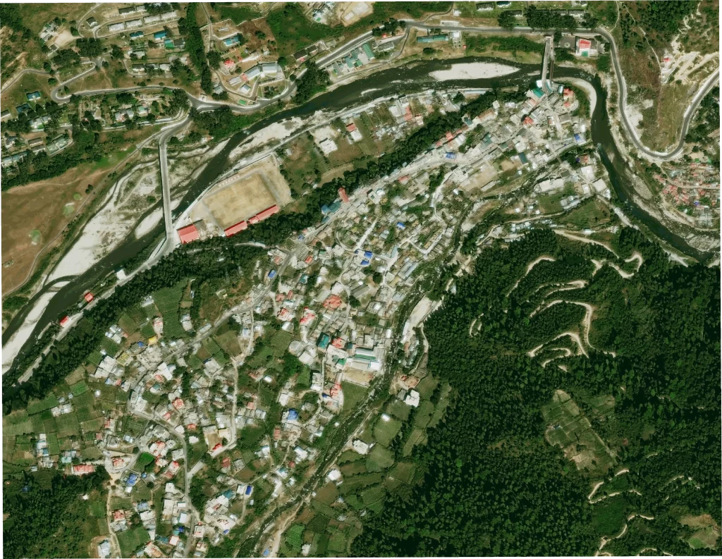
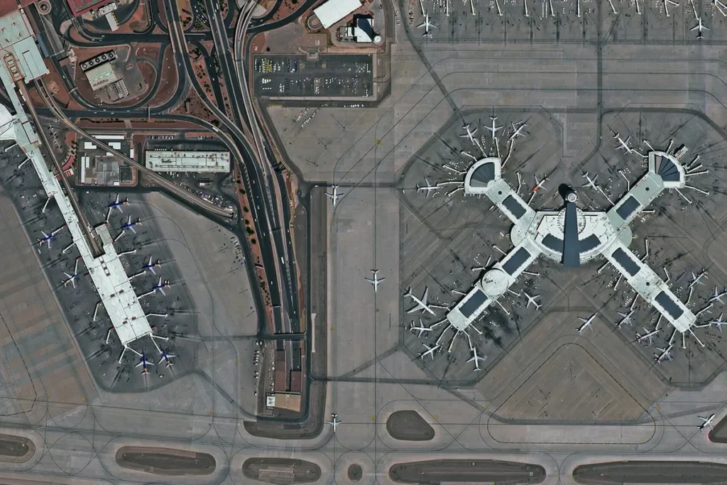
30cm satellite imagery means that each individual pixel in the satellite image represents a 30 cm X 30 cm area on the surface of the Earth.
At this scale, the visual boundary between macro objects disappears. Instead of viewing blurred urban blocks or approximate forest canopies, a 30cm sensor extracts precise, feature-level details—allowing human eyes and AI algorithms to isolate objects with incredible edge definition and spatial accuracy.
30cm satellite imagery
Key Technical Characteristics of 30cm Imagery
- Ultra-High Spatial Resolution: Captures the finest physical details legally allowed for commercial distribution.
- Unmatched Object Detection: Easily isolates minor elements like property fencing, small outbuildings, or localized track corridors.
- Superior Edge Contrast: High radiometric quality creates clear pixel transitions, removing the “blur” from narrow structures.
- Optimized for Machine Learning: Crisp lines provide the high-fidelity pixel gradients needed to train computer vision models without massive false-positive rates.
Industrial Use Cases: Where 30cm Data is Crucial
The cost of 30cm imagery is a premium investment, meaning it is deployed where macro-level mapping falls short.
Smart Cities & Advanced Urban Mapping
In high-density municipal areas, planners use 30cm data to automatically generate building footprints, identify illegal property extensions, and support identification of major transportation assets and visible lane markings
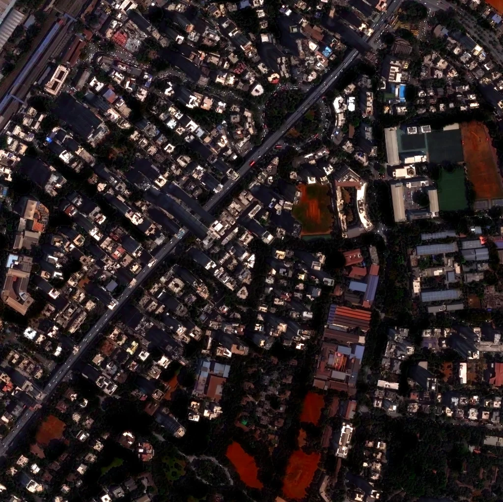
Urban Infrastructure & Construction Monitoring
Utility agencies, infrastructure planners, and construction managers use 30 cm imagery to monitor utility corridors, assess rooftop conditions, track construction progress, and observe equipment deployment across active urban and civil infrastructure sites. In dense urban areas, it supports identification of major assets and site-level changes.

Defense, Security, and Strategic Monitoring
Sub-meter spatial intelligence is foundational for modern defense operations. 30cm optical and radar footprints provide accurate terrain intelligence, aircraft and naval vessel classification, and immediate battle damage assessments (BDA).
Leading Constellations: Who Provides 30cm Spatial Intelligence?
To fully utilize 30cm data, it helps to understand the commercial New Space ecosystems supplying it:

Vantor (Formerly Maxar Intelligence)
The premier entity in commercial electro-optical imaging. Operating elite satellites like WorldView-3 and the advanced WorldView Legion fleet, Vantor delivers native resolutions between 30 cm to 50 cm. Their standard-setting collections drive the global supply of 30cm basemaps.

Synspective
To overcome cloud cover limitations that block traditional optical lenses, Synspective utilizes a fleet of StriX Synthetic Aperture Radar (SAR) microsatellites. Through its unique Staring Spotlight Mode, Synspective achieves high-resolution radar imaging down to 25cm–2.6 m, delivering 30cm-class performance through absolute weather and nighttime conditions.
Frequently Asked Questions (FAQs)
Can you see an individual person with 30cm satellite imagery?
No. At 30cm resolution, a human being occupies roughly one or two pixels, appearing as an unrecognizable dot. For privacy and technical reasons, commercial satellites cannot identify individual people or read license plates.
What is the difference between native 30cm imagery and HD imagery?
Native 30cm imagery is collected directly at that resolution by the satellite’s optical sensors. HD imagery (such as Vantor’s 15cm HD) takes native high-resolution data and applies proprietary mathematical algorithms to intelligently increase the pixel density, sharpening edges and improving visual clarity for human analysts.
How does weather affect 30cm optical data collection?
Optical sensors require clear skies and good lighting. Heavy cloud cover, smoke, or darkness will obstruct the view. To counter this, operators pair optical imagery with ultra-high-resolution radar options like Synspective’s SAR constellation, which can image at a sub-50cm scale regardless of weather or daylight.
Sanchita Maitri
GIS Engineer


